Plansee
Tyrol's second largest lake, on the German border, joined to the Heiterwanger See by a short channel.
Updated 18 October 2026
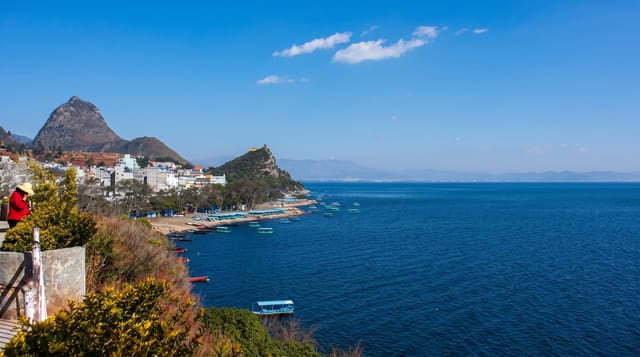
The Plansee lies at about a thousand metres in the Ammergau Alps close to the German border and is, after the Achensee, the second largest lake in Tyrol - four kilometres long, deep, cold and a strong blue-green, with steep wooded slopes and rock coming down to it on both sides. A short canal joins it to the neighbouring Heiterwanger See, so the two function as one body of water and a boat service runs between them; it is one of very few places in the Alps where you can pass from one lake to another by boat. The road along the northern shore continues over into Bavaria towards Linderhof and Ettal, which makes the lake a standard stop on that route. Diving and sailing are both established here, and the water is very clear.
History
The Plansee and the Heiterwanger See are probably remains of an Ice Age meltwater lake that once filled the whole Zwischentoren area, and the Plansee is first named, as Planse, in a boundary description of the diocese of Freising of 1073-1078. The Tyrolean princes and Steingaden monastery held fishing rights here, as did Stams monastery from the 15th century; Duke Siegmund and Emperor Maximilian I tried to take the best fishing waters, and Maximilian's fishing book of 1500 calls the two lakes especially important for his sport, but Stams kept a limited right, confirmed by Archduke Leopold V in 1631. The Plansee power plant began working in 1902, and the canal to the Heiterwanger See was dug in 1908 and widened in 1951 (Wikipedia, Plansee).
What you'll find
- Tyrol's second largest lake - four kilometres of deep blue-green water.
- A channel to a second lake - the canal linking it to the Heiterwanger See.
- A boat between two lakes - the service running through the connection.
- Steep wooded shores - forest and rock down to the waterline on both sides.
When to go
May to September. Half a day.
Things to know
The water is very cold - this is a high lake, not a swimming resort. Shore access is limited to a few points along the road. Boat services are seasonal and weather-dependent.
Nearby
Reutte and the Highline 179 bridge are east; Linderhof and Ettal are over the German border.
Key facts
Source: Wikidata, item Q575489, read on 18 October 2026.
What to pack for Plansee
Chosen from what this place is for. Tap a kit for the full checklist.
- Travel rod + reel - A packable multi-piece rod fits in a case and covers most holiday fishing. Find on Amazon
- Reef-safe sunscreen - High SPF that will not bleach the coral you are swimming over. Find on Amazon
- Your own mask + snorkel - A well-fitting mask is the single biggest comfort upgrade underwater. Find on Amazon
- Modest clothing - Shoulders and knees covered - the single most common requirement. Find on Amazon
Some links on this page are Amazon affiliate links - if you buy through them we may earn a small commission at no extra cost to you.
All packing kitsPlan your trip
Where to start if Plansee is going on the list.
Booking links on this page are affiliate links - if you book through them we may earn a small commission at no extra cost to you. It never changes what we write about a place.
Opening times, ticket prices and seasonal closures change - check the official source before you go: official site.