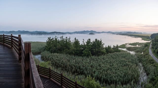
Ottenstein Reservoir
A branching Waldviertel reservoir on the Kamp, drained every few years to reveal a drowned village and bridge.
Updated 29 August 2026
Ottenstein is the largest of the three reservoirs built on the Kamp in the Waldviertel, dammed in 1957, and its shape is the point: the river ran through a deeply incised winding valley, so flooding it produced a lake with long narrow arms reaching back into wooded side valleys, about four hundred hectares of water with a shoreline out of all proportion to its area. Boats, sailing and swimming are the summer use, with a marina and bathing spots along the shore. Every few years the reservoir is drawn down for inspection of the dam, and when the level drops the things the water covered emerge - the old road, a stone bridge, foundations of buildings from the valley floor - which draws crowds for the few weeks it lasts. Ottenstein castle stands above the water.
Highlights
- A branching reservoir - long arms flooding the old winding Kamp valley.
- A drowned valley emerging - road, bridge and foundations when the level drops.
- Sailing and swimming - the marina and bathing spots along the shore.
- Ottenstein castle - the fortress standing above the flooded valley.
When to go
May to September for the water; drawdown years for the ruins. Half a day.
Things to know
The drawdown happens only every few years and is announced in advance - do not expect it. Shore access is limited in places by private land. The water is cold and the depth drops off fast.
Nearby
Zwettl Abbey is west; the Kamptal wine country runs downstream.
Key facts
Source: Wikidata, item Q1417413, read on 18 October 2026.
What to pack for Ottenstein Reservoir
Chosen from what this place is for. Tap a kit for the full checklist.
- Reef-safe sunscreen - High SPF that will not bleach the coral you are swimming over. Find on Amazon
- Quick-dry towel - A microfibre towel packs small and dries in minutes. Find on Amazon
- Water shoes - Protect your feet on rocky entries, hot sand and sea-urchin spines. Find on Amazon
- Dry bag - Keeps phone, cash and keys safe while you are in the water. Find on Amazon
Some links on this page are Amazon affiliate links - if you buy through them we may earn a small commission at no extra cost to you.
All packing kitsPlan your trip
Where to start if Ottenstein Reservoir is going on the list.
Booking links on this page are affiliate links - if you book through them we may earn a small commission at no extra cost to you. It never changes what we write about a place.
Opening times, ticket prices and seasonal closures change - check the official source before you go: official site.