Oodnadatta Track
Six hundred kilometres of dirt following the old Ghan railway and a line of mound springs across the desert.
Updated 18 October 2026
AI illustration
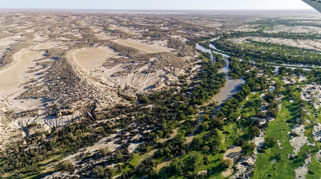
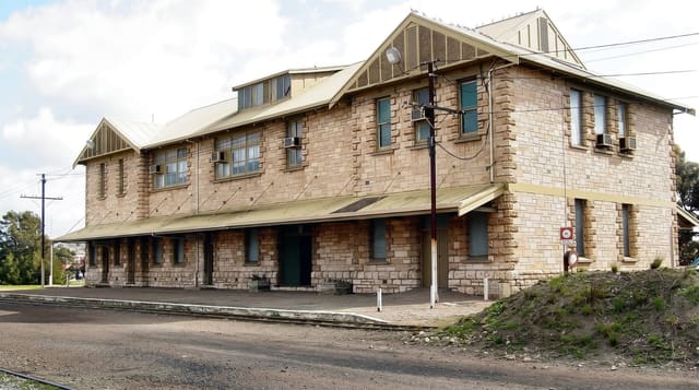
The Oodnadatta Track runs about six hundred and twenty kilometres of dirt from Marree to Marla, following a route used by Aboriginal people for thousands of years because it links a line of mound springs, natural artesian outlets that provided the only reliable water across the desert. The old Ghan railway followed the same line until it was rerouted in 1980, and the track passes its ruins: sidings, bridges, water tanks and the abandoned settlements that served them. Along the way are Lake Eyre South, the Coward Springs bore and wetland, Algebuckina bridge, Australia's longest rail bridge when it was built, and the Pink Roadhouse at Oodnadatta.
History
The track follows an Aboriginal trading route linked by springs of the Great Artesian Basin, the water that later decided the route of the Central Australia Railway, the original Ghan, and John McDouall Stuart came this way on his third expedition in 1859, naming Peake Creek. Railway sidings, bridges and buildings and repeater stations of the Overland Telegraph Line still stand along it, among them the ruins at Curdimurka and the Peake telegraph station near Angle Pole, where the line turned north (Wikipedia, Oodnadatta Track).
Highlights
- The Ghan ruins - sidings, bridges and abandoned railway settlements.
- The mound springs - artesian outlets including the Bubbler and Blanche Cup.
- Coward Springs - the old bore with a soaking pool and campground.
- The Pink Roadhouse - the Oodnadatta institution halfway along.
When to go
April to September; summer temperatures pass forty-five degrees and travel is hazardous. Rain closes the track completely, with fines for driving on closed roads, and closures can last days. Fuel stops are at Marree, William Creek, Oodnadatta and Marla only.
Before you go
The surface is corrugated dirt and hard on vehicles; punctures are routine and two spares are advisable. There is no phone coverage over most of it. Fuel is expensive and distances between stops exceed two hundred kilometres.
Nearby
Lake Eyre lies alongside the route; the Birdsville Track runs north from Marree.
Key facts
Source: Wikidata, item Q828516, read on 18 October 2026.
What to pack for Oodnadatta Track
Chosen from what this place is for. Tap a kit for the full checklist.
- Loose, light, long clothing - Covering up beats bare skin in the desert - and locals dress this way for a reason. Find on Amazon
- Comfortable walking shoes - Sightseeing means kilometres of pavement and cobbles daily. Find on Amazon
- Shelter suited to the place - Tent, tarp or hut booking - match it to the terrain and rules. Find on Amazon
- A wide-brim hat + sunglasses - Shade for your face and eyes where there is none overhead. Find on Amazon
Some links on this page are Amazon affiliate links - if you buy through them we may earn a small commission at no extra cost to you.
All packing kitsPlan your trip
Where to start if Oodnadatta Track is going on the list.
Booking links on this page are affiliate links - if you book through them we may earn a small commission at no extra cost to you. It never changes what we write about a place.
Opening times, ticket prices and seasonal closures change - check the official source before you go: official site.