Mount Ainslie Lookout
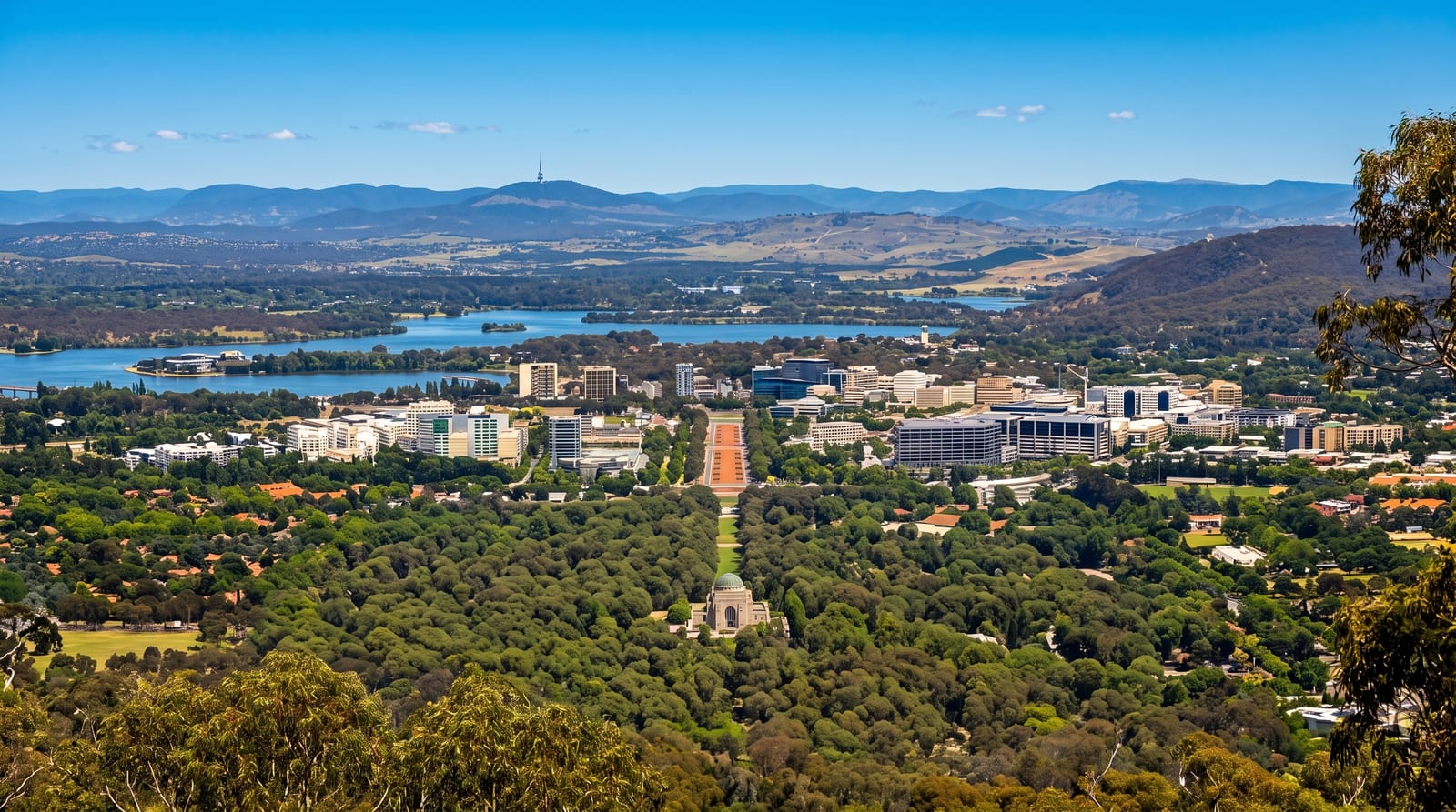
The viewpoint that shows Canberra's geometry, looking straight down the land axis from the War Memorial to Parliament.
Updated 4 September 2026
AI illustration
Mount Ainslie rises 843 metres immediately northeast of Canberra's centre, and from the lookout at the top the city's design becomes legible in a way it never is at ground level: the land axis runs dead straight from the Australian War Memorial below, down Anzac Parade with its memorials, across the lake, through Old Parliament House and up to the flagpole of Parliament House on Capital Hill. Burley Griffin planned it that way. A walking track climbs about two kilometres from behind the War Memorial, gaining around two hundred and sixty metres, and a sealed road reaches the summit for those driving. Kangaroos are common on the lower slopes at dusk.
What to look for
- The land axis - the straight line from War Memorial to Parliament House.
- Anzac Parade - the memorial avenue running down from the lookout.
- The city plan - Canberra's geometry visible as a whole.
- The bushland walk - the track up through nature reserve with kangaroos.
When to go
Year-round; sunset gives the best light down the axis and is the busiest time. Winter mornings can be foggy in the valley with clear air above. Summer afternoons are hot on the walking track.
Things to know
The summit car park is small and crowded at sunset. The walking track is steeper than expected and has no water. There is nothing at the top beyond the platform, with no café or facilities.
Nearby
The Australian War Memorial is at the foot of the hill; the city centre lies beyond it.
What to pack for Mount Ainslie Lookout
Chosen from what this place is for. Tap a kit for the full checklist.
- Comfortable walking shoes - Sightseeing means kilometres of pavement and cobbles daily. Find on Amazon
- A slim anti-theft daypack - Zips that close properly; keep it in front in crowds and on transit. Find on Amazon
- A refillable water bottle - Many cities have public fountains; save money and plastic. Find on Amazon
- A light layer + compact umbrella - For museum air-con and a sudden shower. Find on Amazon
Some links on this page are Amazon affiliate links - if you buy through them we may earn a small commission at no extra cost to you.
All packing kitsPlan your trip
Where to start if Mount Ainslie Lookout is going on the list.
Booking links on this page are affiliate links - if you book through them we may earn a small commission at no extra cost to you. It never changes what we write about a place.
Opening times, ticket prices and seasonal closures change - check the official source before you go: official site.