Bay of Fires
A stretch of northeast Tasmanian coast where white sand meets granite boulders covered in bright orange lichen, with free camping along it.
Updated 18 October 2026
AI illustration
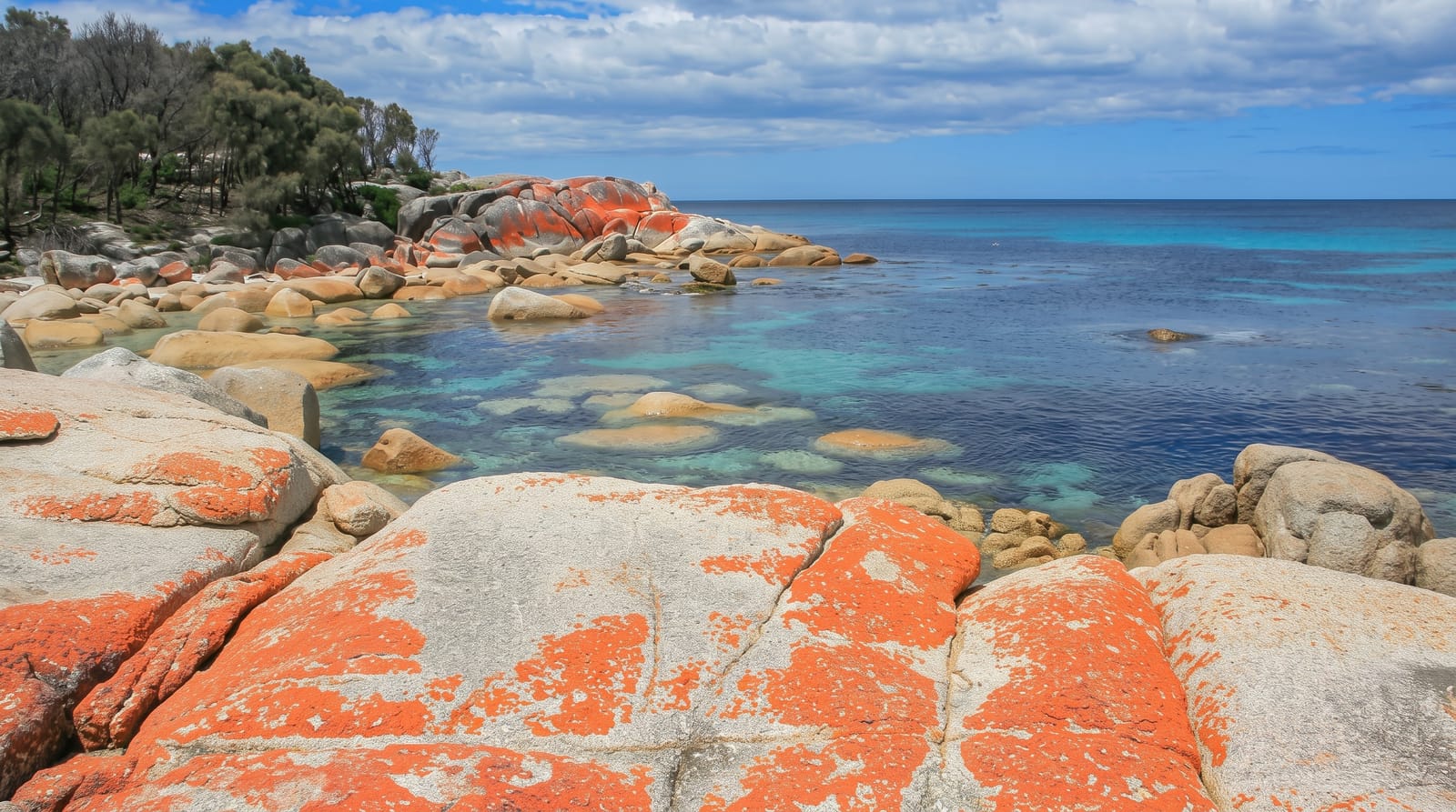
The Bay of Fires is not one bay but a run of coast in northeast Tasmania, from Binalong Bay north towards Eddystone Point. The name comes from a European navigator recording fires burning on the shore in 1773, though what visitors remember is the colour: granite boulders piled along the sand, coated in a bright orange lichen that intensifies in strong light against very white sand and clear shallow water. There is no single viewpoint or entrance. You drive the road north, stop at each pull-off, and walk the sand between boulder clusters. Basic free campsites sit right behind the dunes at The Gardens and Cosy Corner, with no facilities beyond a pit toilet in most of them.
History
The coast, larapuna in palawa kani, was a meeting place for Aboriginal family groups such as the Panpe-kanner, Leener-rerter and Pinter-rairer, and in 1773 Captain Tobias Furneaux of the Adventure named it the Bay of Fires after the fires of Aboriginal people he saw on the beaches; bay whalers worked here in the 1840s (Wikipedia, Bay of Fires).
What you'll find
- Orange lichen boulders - the granite formations that give the coast its colour, strongest in bright sun.
- Binalong Bay - the accessible southern end with a beach and small settlement.
- The Gardens - the road's northern end past a string of coves and campsites.
- Beach walking - long open stretches of white sand between the boulder clusters.
When to go
December to March is warmest and gives the strongest light on the lichen, which looks dull under cloud. That is also when the free campsites fill, sometimes early in the day. Spring and autumn are quieter and often clear. Any time of year the wind off the ocean can be cold enough to end a beach day early.
Things to know
Facilities are almost non-existent: no shops, no drinking water and limited toilets along most of the coast, so you carry what you need. The water is cold even in midsummer and there are no patrolled beaches. Campsites are first come first served and busy over summer. Under grey skies the famous colours largely disappear.
Nearby
St Helens is the service town, with Mount William National Park north and Freycinet down the coast.
Key facts
Source: Wikidata, item Q605474, read on 18 October 2026.
What to pack for Bay of Fires
Chosen from what this place is for. Tap a kit for the full checklist.
- Reef-safe sunscreen - High SPF that will not bleach the coral you are swimming over. Find on Amazon
- Loose, light, long clothing - Covering up beats bare skin in the desert - and locals dress this way for a reason. Find on Amazon
- Shelter suited to the place - Tent, tarp or hut booking - match it to the terrain and rules. Find on Amazon
- Quick-dry towel - A microfibre towel packs small and dries in minutes. Find on Amazon
Some links on this page are Amazon affiliate links - if you buy through them we may earn a small commission at no extra cost to you.
All packing kitsPlan your trip
Where to start if Bay of Fires is going on the list.
Booking links on this page are affiliate links - if you book through them we may earn a small commission at no extra cost to you. It never changes what we write about a place.
Opening times, ticket prices and seasonal closures change - check the official source before you go: official site.