Chott Melrhir
The largest salt lake in Algeria, a vast crusted basin below sea level south of Biskra.
Updated 31 August 2026
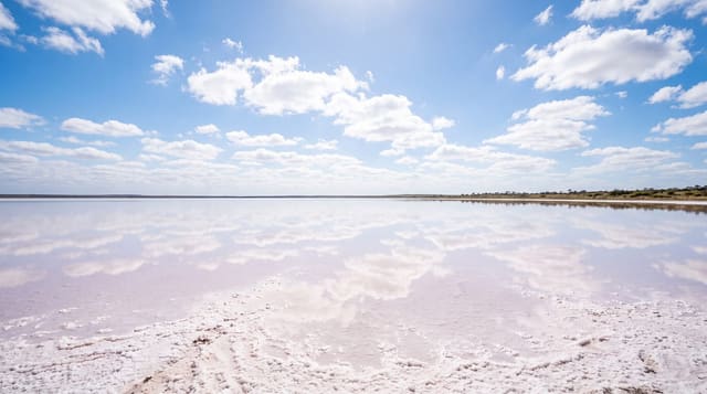
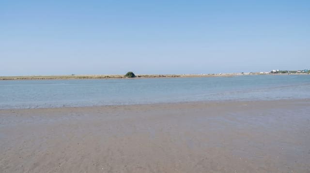
Chott Melrhir is the largest of the Algerian salt lakes, a shallow endorheic basin south of the Aures whose floor lies some forty metres below sea level, filling with a thin sheet of water after winter rain and drying through the summer into a crust of salt and mud that stretches beyond sight. Nothing grows on it. In wet years it draws flamingos and waders in numbers, and the edges carry salt-tolerant scrub grazed by camels. The surface reflects the sky when flooded and glares white when dry, and the roads from Biskra toward El Oued run along its northern side, which is how most people see it, as a change in the horizon rather than a destination.
The landscape
- A salt basin below sea level - the lowest ground in the country.
- Winter flooding and flamingos - the birds that arrive in wet years.
- Salt crust in summer - the white surface when the water is gone.
- Camels on the salt-tolerant edges - the grazing around the basin.
When to go
November to March, when there may be water, birds and bearable temperatures. Half a day as a stop. Summer heat here is extreme and the basin is featureless.
What to expect
Driving onto the chott is dangerous: the crust hides deep mud and vehicles get stuck to the axle. There are no facilities, shade or water anywhere near it. Flamingos depend entirely on rainfall and are often absent. The heat from May to September is severe.
Nearby
Biskra is north-west; El Oued lies east.
Key facts
Source: Wikidata, item Q584255, read on 18 October 2026.
What to pack for Chott Melrhir
Chosen from what this place is for. Tap a kit for the full checklist.
- Broken-in walking shoes or boots - Grip and ankle support matter more than looks; never hike in brand-new boots. Find on Amazon
- Layers + a waterproof shell - Mountain weather turns fast; a packable rain jacket saves the day. Find on Amazon
- Daypack with rain cover - 20-30 litres holds water, snacks, layers and a first-aid kit. Find on Amazon
- Offline maps + a power bank - Download the trail before you lose signal; carry backup charge. Find on Amazon
Some links on this page are Amazon affiliate links - if you buy through them we may earn a small commission at no extra cost to you.
All packing kitsPlan your trip
Where to start if Chott Melrhir is going on the list.
Booking links on this page are affiliate links - if you book through them we may earn a small commission at no extra cost to you. It never changes what we write about a place.
Opening times, ticket prices and seasonal closures change - check the official source before you go: official site.