Mam Tor
A shale hill that keeps sliding downhill, taking a main road with it, with an Iron Age hillfort on the ridge above the wreckage.
Updated 4 September 2026

AI illustration
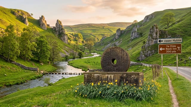
The hill is built of alternating shale and gritstone, and the shale slumps, which is why it is called the Shivering Mountain: the east face is a permanent landslip that has been moving for around four thousand years and is still going. The A625 was built across the slip in 1819, repaired repeatedly, and finally abandoned in 1979; the broken road is still there, buckled into steps and tilted slabs, and walking along it is the clearest demonstration of active geology in England. The 517-metre summit carries a univallate hillfort with ramparts enclosing about six hectares and two Bronze Age barrows inside, one of the highest forts in the country. The ridge walk east over Hollins Cross to Lose Hill is the standard route, with the Hope and Edale valleys on either side.
Highlights
- The broken road - the A625 buckled and abandoned to the landslip in 1979.
- The hillfort - ramparts round about six hectares on the 517-metre summit.
- The active slip - a shale face that has been moving for four thousand years.
- The ridge walk - the traverse to Lose Hill between Edale and Hope.
When to go
April to October for the walking; the summit is exposed and the ridge is unpleasant in wind and rain. Sunrise from the ridge is a well-known draw and the small car park fills before dawn on clear mornings.
What to expect
Parking is very limited and the verges get clogged, with regular ticketing. The path to the summit is paved and can be slick, and the ridge is exposed with a steep drop on the north side. It is one of the busiest hills in the Peak District on weekends.
Nearby
Castleton and its show caves lie below; Edale and Kinder Scout are north.
Key facts
Source: Wikidata, item Q6745232, read on 18 October 2026.
What to pack for Mam Tor
Chosen from what this place is for. Tap a kit for the full checklist.
- Broken-in walking shoes or boots - Grip and ankle support matter more than looks; never hike in brand-new boots. Find on Amazon
- Head torch + spare batteries - Hands-free light is essential; caves are truly dark. Find on Amazon
- Layers + a waterproof shell - Mountain weather turns fast; a packable rain jacket saves the day. Find on Amazon
- Grippy closed shoes - Cave floors are wet, muddy and slick with formations. Find on Amazon
Some links on this page are Amazon affiliate links - if you buy through them we may earn a small commission at no extra cost to you.
All packing kitsPlan your trip
Where to start if Mam Tor is going on the list.
Booking links on this page are affiliate links - if you book through them we may earn a small commission at no extra cost to you. It never changes what we write about a place.
Opening times, ticket prices and seasonal closures change - check the official source before you go: official site.