Wat Tha Ton
Nine levels of shrines climbing a hill above the Kok river near the Myanmar border, each with its own view and figure.
Updated 12 October 2026
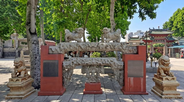
Wat Tha Ton climbs a hill above the Kok river at Tha Ton, close to the Myanmar border in the far north of Chiang Mai province, in nine numbered levels built up over decades. Each level has its own shrine or statue - a white Guanyin figure, a large seated Buddha, a standing Buddha, a chedi, a Chinese-style pavilion, a naga - and its own view over the river valley, the town and the hills toward Myanmar, with the highest levels giving the widest outlook. A road runs between them so it can be driven rather than climbed, which most people do. The mix of Thai Buddhist, Chinese and other elements across the levels is characteristic of temples in this border region, where Shan, Yunnanese Chinese, Lahu, Akha and Thai communities live alongside each other. Tha Ton is the departure point for longtail boats down the Kok river to Chiang Rai, which is the other reason people are there.
Highlights
- The nine levels - shrines and statues climbing the hill, each with a view.
- The white Guanyin - the Chinese figure on one of the upper levels.
- The border outlook - the Kok valley and hills toward Myanmar.
- The mixed traditions - Thai, Chinese and border-region elements together.
When to go
November to February. Early or late for the light over the valley. The road between levels means it can be driven; two hours covers it.
Things to know
Everything is modern construction added over recent decades. It is a long drive from Chiang Mai - 175 kilometres on mountain roads. Free with donation boxes at each level. Temple dress code applies.
Nearby
The Kok river boats to Chiang Rai leave from Tha Ton; Fang and Doi Ang Khang are south.
Key facts
Source: Wikidata, item Q63617065, read on 18 October 2026.
What to pack for Wat Tha Ton
Chosen from what this place is for. Tap a kit for the full checklist.
- Comfortable walking shoes - Sightseeing means kilometres of pavement and cobbles daily. Find on Amazon
- Modest clothing - Shoulders and knees covered - the single most common requirement. Find on Amazon
- A slim anti-theft daypack - Zips that close properly; keep it in front in crowds and on transit. Find on Amazon
- A scarf or shawl - To cover the head or shoulders on entry; women especially at mosques. Find on Amazon
Some links on this page are Amazon affiliate links - if you buy through them we may earn a small commission at no extra cost to you.
All packing kitsPlan your trip
Where to start if Wat Tha Ton is going on the list.
Booking links on this page are affiliate links - if you book through them we may earn a small commission at no extra cost to you. It never changes what we write about a place.
Opening times, ticket prices and seasonal closures change - check the official source before you go: official site.