Karakul
The Pamirs' black lake in a meteor scar - a salt lake at 3,900 metres ringed by 6,000-metre peaks, the loneliest beautiful stop on the Highway.
Updated 21 October 2026
AI illustration
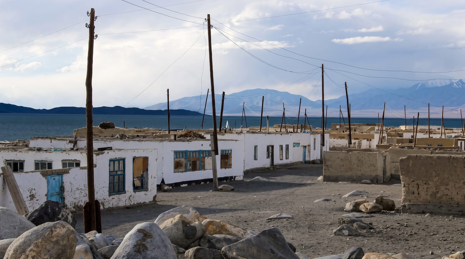
Near the top of the Pamir Highway, where the plateau runs treeless at 3,900 metres, Karakul, about 25 kilometres across at some 3,960 metres, spreads its improbable blue-black sheet inside what scientists read as a meteorite impact basin about 52 kilometres wide and probably less than five million years old, first recognised from space imagery around 1987 - a salt lake with no outlet, too mineral for all but one hardy loach, ringed by white-shouldered peaks that top 6,000 metres and reflected with mirror cruelty on still mornings. The village on its shore is a scatter of white homestay houses where Kyrgyz herding families pour tea against the wind, yaks graze the salt flats, and the silence between vehicles on the Highway is total. It is high, hard country - and one of Central Asia's great overnight stops.
Highlights
- The lake mirror - dawn reflections of the 6,000-metre ring.
- The impact basin - the crater rim ridges reading round the horizon.
- Karakul village - whitewashed homestays and yak herds on the shore.
- The Highway itself - the plateau run toward the Kyzyl-Art pass.
When to go
June to September is the travel season; even then nights freeze and wind is the resident weather. Winter closes in seriously. Mornings before the wind are the lake's performance hours.
Good to know
Altitude is the ruling fact - sleeping at 3,900 metres punishes anyone who raced up from Dushanbe or Osh; build acclimatisation into the Highway itinerary. Comforts are homestay-basic: warm blankets, outdoor facilities, generous hosts. The GBAO permit is required paperwork - arrange with the visa. Swimming is for polar enthusiasts only.
Nearby
Murghab's bazaar to the south, the Kyzyl-Art pass to Kyrgyzstan and the Highway's whole spine.
Key facts
Source: Wikidata, item Q720015, read on 18 October 2026.
What to pack for Karakul
Chosen from what this place is for. Tap a kit for the full checklist.
- Reef-safe sunscreen - High SPF that will not bleach the coral you are swimming over. Find on Amazon
- Warm base layers - Merino or synthetic against the skin - never cotton, which chills when damp. Find on Amazon
- Layers for big temperature swings - Warm sun by day, near-freezing at night, even near the equator. Find on Amazon
- Shelter suited to the place - Tent, tarp or hut booking - match it to the terrain and rules. Find on Amazon
Some links on this page are Amazon affiliate links - if you buy through them we may earn a small commission at no extra cost to you.
All packing kitsPlan your trip
Where to start if Karakul is going on the list.
Booking links on this page are affiliate links - if you book through them we may earn a small commission at no extra cost to you. It never changes what we write about a place.
Opening times, ticket prices and seasonal closures change - check the official source before you go: official site.