The Verzasca Valley
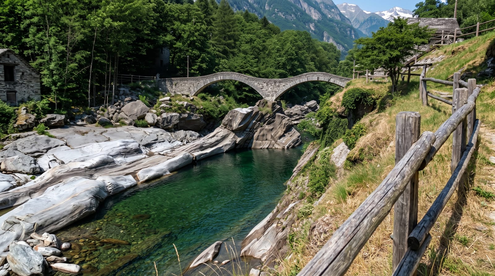
A Ticino valley where a clear green river runs over smooth pale rock, past stone villages and a double arched bridge at Lavertezzo.
Updated 21 October 2026
AI illustration
The Verzasca comes down from the mountains north of Locarno through rock that the water has scoured into curves and basins, and the river running over it is an unusually clear green. At Lavertezzo a stone bridge of two arches jumps between slabs where people sunbathe and swim. Further up, the villages are built of the same grey stone and roofed in slabs of it, with Corippo clinging to a slope opposite the road and Sonogno at the head where the road ends. The valley runs about 25 kilometres from north to south, and at its mouth the river is held back by a dam forming the Lago di Vogorno. A long footpath, the Sentierone, links the settlements along the valley floor, and walking part of it is a better way to see the place than driving between car parks.
What's there
- The rock at Lavertezzo - smooth pale slabs and basins carved by the water.
- The double arched bridge - the old stone span over the river at Lavertezzo.
- Corippo and Sonogno - stone villages with slab roofs further up the valley.
- The Sentierone - the valley footpath linking the villages end to end.
When to go
May to October. June and July carry the fullest river; by late summer the pools are lower and a little warmer. Weekdays and early mornings are far calmer than summer weekends, when the valley road and the car parks at Lavertezzo fill by mid morning. Autumn brings chestnut colour and paths with almost nobody on them.
Things to know
The river is genuinely dangerous: the rock is slippery, currents under the surface are strong and the level can rise fast after rain upstream. Parking is limited, expensive and enforced. On hot weekends Lavertezzo is packed and the banks are littered. Mobile signal comes and goes further up the valley.
Nearby
Locarno and Lake Maggiore at the mouth of the valley, with the Maggia valley to the west.
Key facts
Source: Wikidata, item Q666736, read on 18 October 2026.
What to pack for The Verzasca Valley
Chosen from what this place is for. Tap a kit for the full checklist.
- Broken-in walking shoes or boots - Grip and ankle support matter more than looks; never hike in brand-new boots. Find on Amazon
- Layers + a waterproof shell - Mountain weather turns fast; a packable rain jacket saves the day. Find on Amazon
- Daypack with rain cover - 20-30 litres holds water, snacks, layers and a first-aid kit. Find on Amazon
- Offline maps + a power bank - Download the trail before you lose signal; carry backup charge. Find on Amazon
Some links on this page are Amazon affiliate links - if you buy through them we may earn a small commission at no extra cost to you.
All packing kitsPlan your trip
Where to start if The Verzasca Valley is going on the list.
Booking links on this page are affiliate links - if you book through them we may earn a small commission at no extra cost to you. It never changes what we write about a place.
Opening times, ticket prices and seasonal closures change - check the official source before you go: official site.