Taejongdae
A wooded headland at the southern tip of Busan Yeongdo island, ringed by a road loop past cliffs and a lighthouse.
Updated 21 October 2026
AI illustration
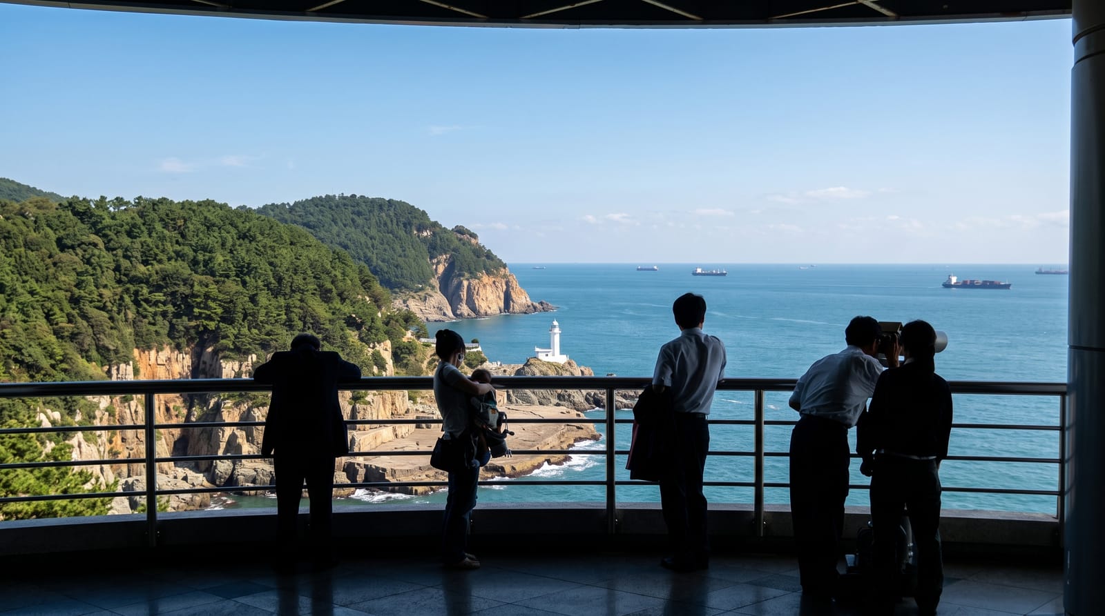
Taejongdae occupies the southern tip of Yeongdo, the island suburb across the bridge from Busan's old harbour, where pine forest ends in cliffs dropping straight into the sea. A looping road runs around the headland through the trees, walkable in an hour or covered by an open road train that stops at the lighthouse, the observation deck and the viewpoint above Sinseon Rock, a broad flat shelf of stone at the foot of the cliff. Steps lead down to the water, where stalls sell shellfish and small boats leave for short trips along the coast. On a genuinely clear day the outline of Tsushima can be made out across the strait. The name is traced to King Taejong Muyeol of Silla, said to have practised archery here.
What you'll find
- The cliffs and lighthouse - the white lighthouse on the rocks at the southern point.
- Sinseon Rock - the flat stone shelf at the base of the cliff, reached by steps.
- The park loop - the wooded road circuit, on foot or by open road train.
- The observation deck - the platform looking out over the strait and passing ships.
When to go
Spring and autumn are the most comfortable for the loop walk, and clear winter days give the longest views across the strait. Mornings are quieter. The road train runs frequently but queues at weekends. Fog rolls in off the sea in early summer and can shut the view down completely within minutes.
What to expect
The loop is a paved road shared with the train and other walkers, so it is a stroll rather than a hike, and the uphill sections are steeper than they look. The steps down to Sinseon Rock are long and the climb back is the sting. Weekends are busy, the food stalls are touristy, and in fog there is nothing to see at all.
Nearby
The Yeongdo bridge, Jagalchi fish market and Gamcheon's hillside lanes are all on the other side of the water.
Key facts
Source: Wikidata, item Q490572, read on 18 October 2026.
What to pack for Taejongdae
Chosen from what this place is for. Tap a kit for the full checklist.
- Broken-in walking shoes or boots - Grip and ankle support matter more than looks; never hike in brand-new boots. Find on Amazon
- Spare batteries + cards - Cold and long shoots drain power; never run out at the good light. Find on Amazon
- Layers + a waterproof shell - Mountain weather turns fast; a packable rain jacket saves the day. Find on Amazon
- A compact tripod - Essential for night skies, aurora, waterfalls and low light. Find on Amazon
Some links on this page are Amazon affiliate links - if you buy through them we may earn a small commission at no extra cost to you.
All packing kitsPlan your trip
Where to start if Taejongdae is going on the list.
Booking links on this page are affiliate links - if you book through them we may earn a small commission at no extra cost to you. It never changes what we write about a place.
Opening times, ticket prices and seasonal closures change - check the official source before you go: official site.