The Edge of the World
A section of the Tuwaiq escarpment northwest of Riyadh where the cliff drops several hundred metres to an empty plain.
Updated 21 October 2026
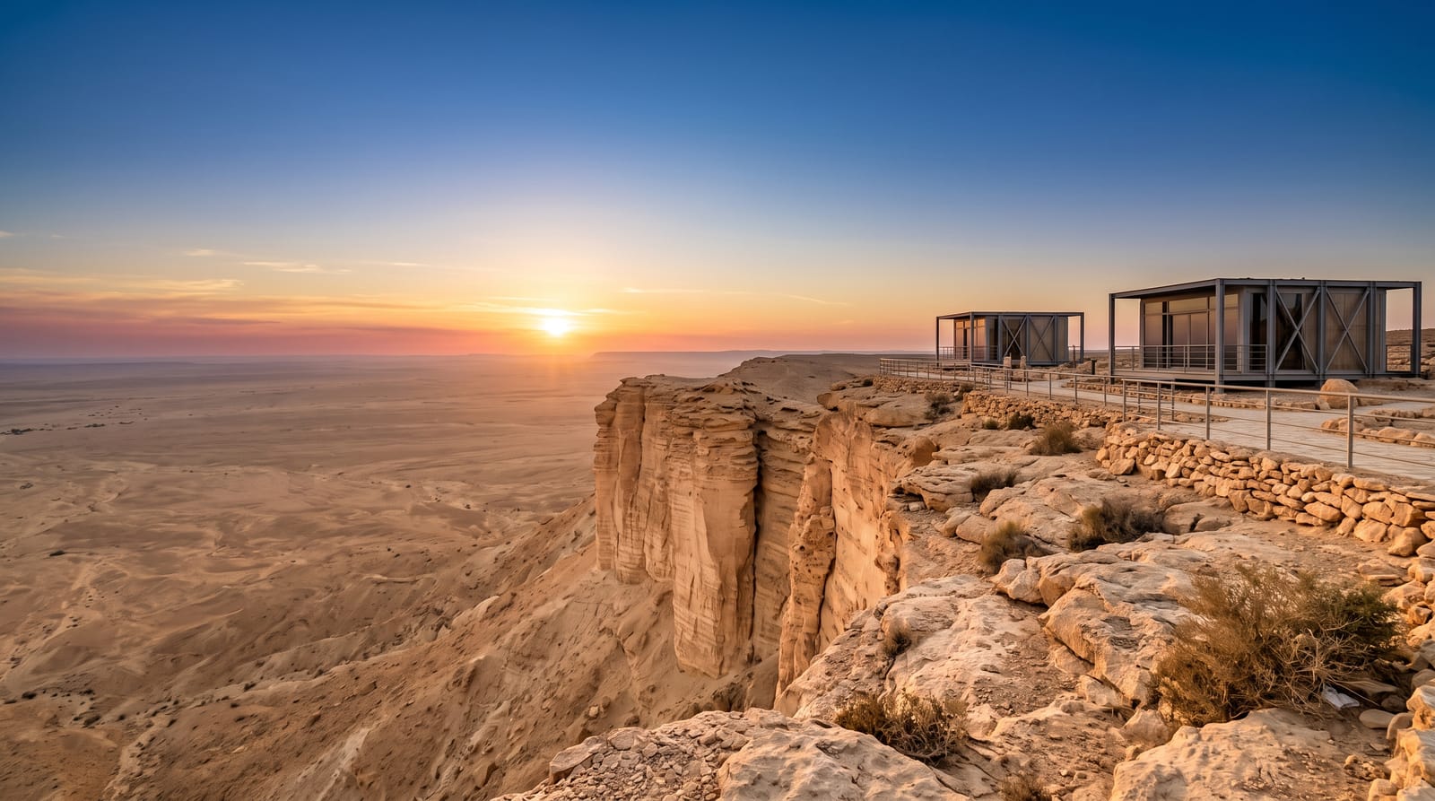
AI illustration
Jebel Fihrayn, known in English as the Edge of the World, is a point on the Tuwaiq escarpment, the limestone cliff line that runs for around eight hundred kilometres through central Arabia, where a promontory juts out and the ground falls several hundred metres to a plain that runs flat to the horizon with nothing on it. The rock is marine limestone full of fossils, laid down when this was seabed. Reaching the viewpoint means leaving the highway for tracks across the plateau, then a short walk out onto the promontory, which is unfenced with a sheer drop on three sides. Riyadh residents camp on the escarpment and tour operators run trips.
The landscape
- The promontory - the cliff point with the drop on three sides.
- The plain below - the flat ground running to the horizon.
- Fossil limestone - the marine fossils in the escarpment rock.
- The Tuwaiq escarpment - the cliff line running north and south.
When to go
November to March; summer here is dangerous with no shade or water. Sunset is when most people go and when the tracks are busiest. Winter nights are cold for camping.
Before you go
The tracks in require four-wheel drive and getting lost is common without a guide or GPS. The cliff edge is completely unfenced. There is no water, shade or facility. Litter left by campers is a serious problem.
Nearby
Riyadh lies southeast; the Red Sands are south.
Key facts
Source: Wikidata, item Q108124406, read on 18 October 2026.
What to pack for The Edge of the World
Chosen from what this place is for. Tap a kit for the full checklist.
- Broken-in walking shoes or boots - Grip and ankle support matter more than looks; never hike in brand-new boots. Find on Amazon
- Spare batteries + cards - Cold and long shoots drain power; never run out at the good light. Find on Amazon
- Shelter suited to the place - Tent, tarp or hut booking - match it to the terrain and rules. Find on Amazon
- Layers + a waterproof shell - Mountain weather turns fast; a packable rain jacket saves the day. Find on Amazon
Some links on this page are Amazon affiliate links - if you buy through them we may earn a small commission at no extra cost to you.
All packing kitsPlan your trip
Where to start if The Edge of the World is going on the list.
Booking links on this page are affiliate links - if you book through them we may earn a small commission at no extra cost to you. It never changes what we write about a place.
Opening times, ticket prices and seasonal closures change - check the official source before you go: official site.