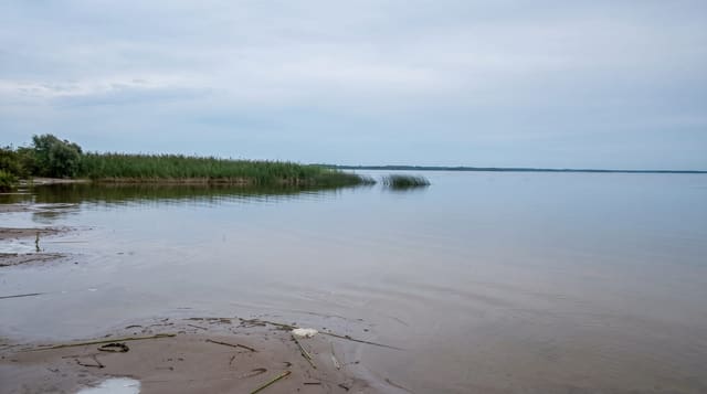
Lake Teletskoye
A deep trough lake in the Altai, seventy-eight kilometres long and three hundred deep, with waterfalls dropping into it.
Updated 14 October 2026
UNESCO World Heritage
Teletskoye fills a tectonic trough deepened by ice, running seventy-eight kilometres with a bend near its middle, only a few kilometres wide, and reaching 325 metres deep - the deepest lake in the Altai and among the deepest in Russia after Baikal. Ridges rise directly from the water on both sides, so most of the shore has no road and is reached only by boat. The Chulyshman enters at the southern end and the Biya flows out at the north. Waterfalls drop straight into the lake from the eastern shore, the Korbu being the best known, reached by boat with a landing platform. The entire eastern shore lies inside the Altaisky nature reserve, part of the Golden Mountains of Altai UNESCO site, which is why access there is permitted only at specific points. The lake is cold, holds thermal stratification, and generates sudden strong winds down its length.
Highlights
- The trough - seventy-eight kilometres long, 325 metres deep between steep ridges.
- The Korbu falls - water dropping into the lake on the reserve shore, reached by boat.
- The roadless shores - most of the lake accessible only by water.
- The reserve - the eastern side inside the Altaisky UNESCO protected area.
When to go
June to September for boats; the lake rarely freezes fully. Two days to a week. Boats south to the Chulyshman take most of a day.
What to expect
Sudden strong winds make the lake dangerous and boats are cancelled or turn back - this is a serious body of water. The water is cold year-round. Reserve shores can be landed on only at set points with permits. Accommodation clusters at Artybash and books out in August.
Nearby
The Chulyshman valley and Uchar are at the southern end; Gorno-Altaysk is west.
Key facts
Source: Wikidata, item Q217109, read on 18 October 2026.
What to pack for Lake Teletskoye
Chosen from what this place is for. Tap a kit for the full checklist.
- Reef-safe sunscreen - High SPF that will not bleach the coral you are swimming over. Find on Amazon
- Quick-dry towel - A microfibre towel packs small and dries in minutes. Find on Amazon
- Water shoes - Protect your feet on rocky entries, hot sand and sea-urchin spines. Find on Amazon
- Dry bag - Keeps phone, cash and keys safe while you are in the water. Find on Amazon
Some links on this page are Amazon affiliate links - if you buy through them we may earn a small commission at no extra cost to you.
All packing kitsPlan your trip
Where to start if Lake Teletskoye is going on the list.
Booking links on this page are affiliate links - if you book through them we may earn a small commission at no extra cost to you. It never changes what we write about a place.
Opening times, ticket prices and seasonal closures change - check the official source before you go: official site.