Vasco da Gama Bridge
Seventeen kilometres of viaduct and cable-stay across the Tagus estuary, built for Expo 98 and long the longest in Europe.
Updated 22 October 2026
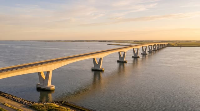
The Vasco da Gama bridge opened in March 1998, weeks before Expo 98, to take through traffic off the 25 de Abril bridge and to link Lisbon directly to the southern bank at its widest point. It runs 17.2 kilometres in total - mostly low viaduct across shallow water and mudflat, with a cable-stayed main span of 420 metres carried on H-shaped pylons 155 metres high - and it was the longest bridge in Europe from completion until 2018. It is built with a curve and a slight gradient, so drivers cannot see the whole length at once, and it is designed to withstand an earthquake 4.5 times stronger than Lisbon's building standards require. The environmental constraint was the Tejo estuary reserve beneath it, one of Europe's most important wetlands, which shaped the piling and construction methods. It is best seen from the Parque das Nações waterfront.
History
Construction began in February 1995, and the bridge opened to traffic on 29 March 1998, in time for Expo 98, which marked 500 years since Vasco da Gama found the sea route to India. The $1.1 billion project was built in four parts by different companies, with up to 3,300 workers at once, and its deepest piles go down 95 metres below mean sea level (Wikipedia, Vasco da Gama Bridge).
The main sights
- The length - 17.2 kilometres, mostly viaduct over shallow estuary water.
- The cable-stayed span - a 420-metre main span on 155-metre pylons.
- The seismic design - built for a quake 4.5 times Lisbon's building standard.
- The estuary - the Tejo reserve wetland the bridge crosses.
When to go
Year-round. Twenty minutes to drive across; an hour to view from the Parque das Nações waterfront, best at sunset. Tolled in both directions.
Practical notes
There is no pedestrian or cycle access - it can only be driven, and the toll applies. Drivers see little of the structure because of the curve. Fog closes it occasionally. Viewing is from the Lisbon bank rather than on it.
Nearby
Parque das Nações and the Oceanário are at the Lisbon end; Alcochete and the estuary reserve are across.
Key facts
Source: Wikidata, item Q233737, read on 18 October 2026.
What to pack for Vasco da Gama Bridge
Chosen from what this place is for. Tap a kit for the full checklist.
- Comfortable walking shoes - Sightseeing means kilometres of pavement and cobbles daily. Find on Amazon
- A slim anti-theft daypack - Zips that close properly; keep it in front in crowds and on transit. Find on Amazon
- A refillable water bottle - Many cities have public fountains; save money and plastic. Find on Amazon
- A light layer + compact umbrella - For museum air-con and a sudden shower. Find on Amazon
Some links on this page are Amazon affiliate links - if you buy through them we may earn a small commission at no extra cost to you.
All packing kitsPlan your trip
Where to start if Vasco da Gama Bridge is going on the list.
Booking links on this page are affiliate links - if you book through them we may earn a small commission at no extra cost to you. It never changes what we write about a place.
Opening times, ticket prices and seasonal closures change - check the official source before you go: official site.