Sagres Fortress
A wall across a windswept promontory at Portugal's south-western tip, tied to Henry the Navigator on thin evidence.
Updated 22 October 2026
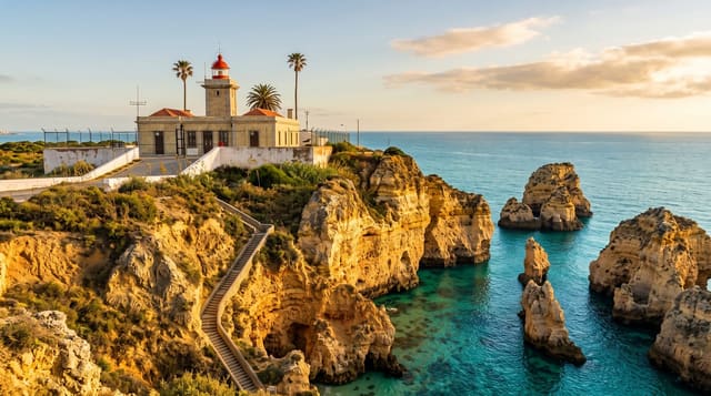
The fortress is a single long wall and gateway sealing off a flat promontory that runs out into the Atlantic and drops in cliffs on three sides - a bleak, treeless, permanently windy place, which is much of the point. Henry the Navigator had a presence at Sagres in the fifteenth century and died nearby in 1460, and from that grew the durable story of a school of navigation here, with astronomers, cartographers and shipwrights assembled to plan the voyages. Historians have long doubted it: there is no contemporary evidence of a formal school, and the tale seems to have been assembled later. On the promontory is a large stone rose compass, uncovered in the 1920s and of uncertain date, a small chapel, and a modern visitor building. Cabo de São Vicente, with its lighthouse and the actual south-western corner of Europe, is six kilometres west.
History
The Greek historian Ephorus called the headland Hieron Akroterion, the Sacred Promontory, in the 4th century BC, and the Romans knew it as Promontorium Sacrum. Henry the Navigator had the fortress built in the 15th century; it was heavily damaged in the 1755 earthquake and rebuilt in the late 18th century with significant remodelling (Wikipedia, Fortress of Sagres).
What you'll find
- The wall - a single fortification sealing off the promontory from the land.
- The stone compass - a large rose uncovered in the 1920s, of uncertain date.
- The cliffs - drops on three sides with the Atlantic beyond.
- The school story - a durable tradition that contemporary evidence does not support.
When to go
April to October. Two hours. Late afternoon for light. The wind blows hard here in any season.
What to expect
The navigation school is very likely a later invention, presented on site more confidently than the evidence allows. The promontory is bare with no shade and relentless wind. Cliff edges are unfenced. Fishermen sit on the very edge, which is not an invitation.
Nearby
Cabo de São Vicente is six kilometres west; Sagres town and its beaches are east.
Key facts
Source: Wikidata, item Q516573, read on 18 October 2026.
What to pack for Sagres Fortress
Chosen from what this place is for. Tap a kit for the full checklist.
- Reef-safe sunscreen - High SPF that will not bleach the coral you are swimming over. Find on Amazon
- Comfortable walking shoes - Sightseeing means kilometres of pavement and cobbles daily. Find on Amazon
- Modest clothing - Shoulders and knees covered - the single most common requirement. Find on Amazon
- Quick-dry towel - A microfibre towel packs small and dries in minutes. Find on Amazon
Some links on this page are Amazon affiliate links - if you buy through them we may earn a small commission at no extra cost to you.
All packing kitsPlan your trip
Where to start if Sagres Fortress is going on the list.
Booking links on this page are affiliate links - if you book through them we may earn a small commission at no extra cost to you. It never changes what we write about a place.
Opening times, ticket prices and seasonal closures change - check the official source before you go: official site.