Mount Isarog Natural Park
Naga's forested volcano - rainforest trails, the Malabsay and Nabontolan falls and a summit crater, protecting Bicol's richest remaining forest.
Updated 22 October 2026

AI illustration
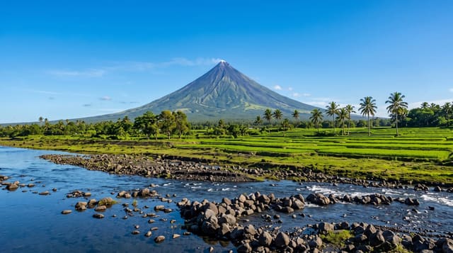
Isarog stands just east of Naga City at nearly two thousand metres, an inactive volcano whose slopes hold the largest block of forest left in the Bicol peninsula - lowland rainforest giving way to montane and mossy forest, with a species list that includes endemic rodents described from this mountain alone, hornbills, and the region's remaining large trees. For most visitors the park means the accessible edges: Malabsay Falls, a broad drop reached by a short walk from the Panicuason side, the hot springs and resorts on the same slope, and Nabontolan and Consocep falls elsewhere around the base. For climbers it means a demanding two-day route through leech-heavy mossy forest to the crater rim, arranged with permits and guides. The mountain also supplies Naga's water, which is why the park's boundaries and the pressure of farming up its slopes are a live local issue rather than an abstraction.
History
The mountain has been the ancestral land of the Isarog Agta people for thousands of years. A forest reserve was created here on 17 August 1935, later replaced by a national park, and on 20 June 2002 Mount Isarog became a protected area as a natural park (Wikipedia, Mount Isarog).
The landscape
- Malabsay Falls - the broad drop near the Panicuason gate.
- The rainforest - lowland to mossy forest up the slopes.
- The crater rim - the two-day climbers' objective.
- The hot springs - thermal resorts on the mountain's flank.
When to go
November to April for the driest trails; Bicol is one of the wettest and most typhoon-exposed regions, so plans should stay flexible. Summit climbs need permits arranged ahead.
Things to know
Trails are muddy and leeches are common in wet spells. The summit route is long, steep and cold at the top. Falls near the gate are family-easy; the mountain proper is not.
Nearby
Naga City's Peñafrancia sites, the Camarines Sur watersports complex and the road toward Caramoan lie around the mountain.
Key facts
Source: Wikidata, item Q1673747, read on 18 October 2026.
What to pack for Mount Isarog Natural Park
Chosen from what this place is for. Tap a kit for the full checklist.
- Broken-in walking shoes or boots - Grip and ankle support matter more than looks; never hike in brand-new boots. Find on Amazon
- Binoculars - The single best wildlife tool - even a compact pair transforms a sighting. Find on Amazon
- Strong insect repellent - DEET or picaridin; the jungle is where bites and disease risk are highest. Find on Amazon
- Swimwear - Needed at most public thermal pools; some traditional baths are nude and single-sex. Find on Amazon
Some links on this page are Amazon affiliate links - if you buy through them we may earn a small commission at no extra cost to you.
All packing kitsPlan your trip
Where to start if Mount Isarog Natural Park is going on the list.
Booking links on this page are affiliate links - if you book through them we may earn a small commission at no extra cost to you. It never changes what we write about a place.
Opening times, ticket prices and seasonal closures change - check the official source before you go: official site.