Lofoten Islands
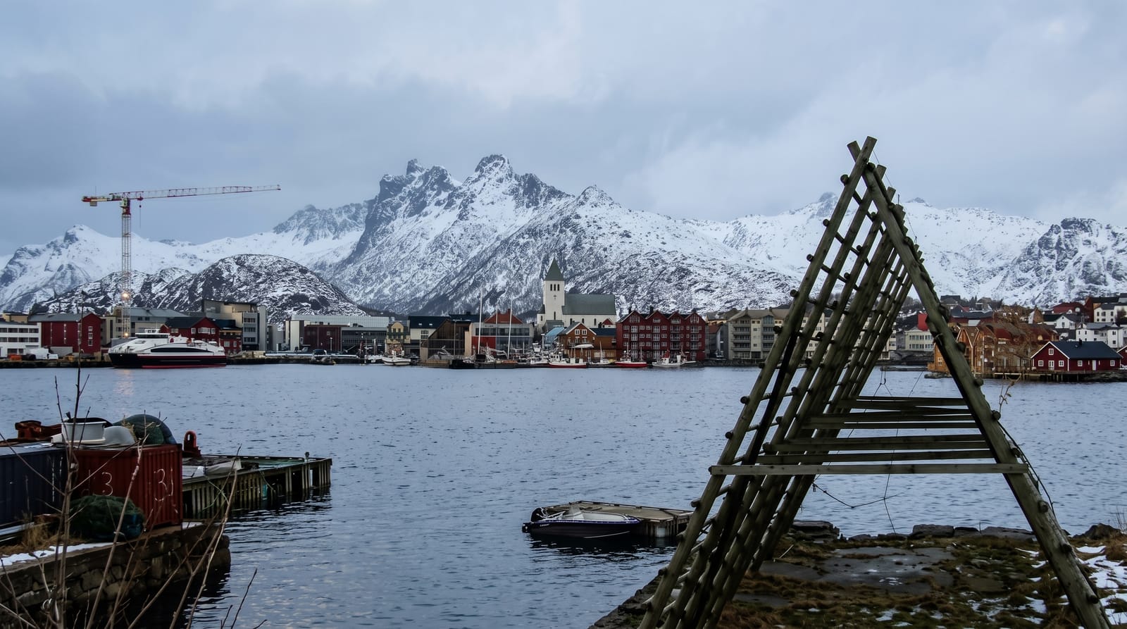
A wall of jagged peaks rising straight from the sea above red fishing villages and white beaches - the most dramatic archipelago in Norway.
Updated 21 October 2026

AI illustration
The Lofoten islands string out into the Norwegian Sea above the Arctic Circle as a wall of sharp peaks rising straight from the water, their feet lined with red fishermen's cabins, white-sand beaches and drying racks of cod. Linked by a scenic road and bridges, they are the most spectacular islands in the country.
History
Human settlement here reaches back at least 11,000 years, and Iron Age farming and habitation can be traced to about 250 BC. Vágar, near today's Kabelvåg, was the first known town in northern Norway, and for more than 1,000 years the islands have been the centre of great winter cod fisheries, with the catch long exported south through Bergen (Wikipedia, Lofoten).
What you'll find
- Reine and Hamnoy - the classic red-cabin villages beneath towering peaks.
- White-sand beaches - Haukland, Kvalvika and Uttakleiv, Arctic beaches of turquoise water.
- The peaks - the jagged mountains rising sheer from the sea, laced with hikes.
- The cod fishery - the winter cod, the drying racks and the fishing heritage of the islands.
When to go
Summer for hiking, beaches and the midnight sun; late winter for the northern lights, the cod season and snow on the peaks. Spring and autumn are quieter between the two.
Practical notes
The islands are strung out over a long distance, so getting around takes time and ideally a car. Summer is increasingly busy with the fame the photos have brought, and accommodation books far ahead. The famous turquoise beaches are Arctic-cold, more for looking than swimming.
Nearby
Senja and the Vesteralen islands lie to the north; the mainland and the Arctic city of Bodo connect by ferry.
Key facts
Source: Wikidata, item Q186822, read on 18 October 2026.
What to pack for Lofoten Islands
Chosen from what this place is for. Tap a kit for the full checklist.
- Broken-in walking shoes or boots - Grip and ankle support matter more than looks; never hike in brand-new boots. Find on Amazon
- Travel rod + reel - A packable multi-piece rod fits in a case and covers most holiday fishing. Find on Amazon
- Reef-safe sunscreen - High SPF that will not bleach the coral you are swimming over. Find on Amazon
- Spare batteries + cards - Cold and long shoots drain power; never run out at the good light. Find on Amazon
Some links on this page are Amazon affiliate links - if you buy through them we may earn a small commission at no extra cost to you.
All packing kitsPlan your trip
Where to start if Lofoten Islands is going on the list.
Booking links on this page are affiliate links - if you book through them we may earn a small commission at no extra cost to you. It never changes what we write about a place.
Opening times, ticket prices and seasonal closures change - check the official source before you go: official site.