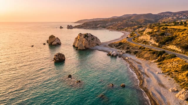
Whatipu Beach
A vast wetland-backed beach at the Manukau bar, where the sea retreated and left dunes, swamp and caves inland.
Updated 21 October 2026
Whatipu sits at the northern head of the Manukau Harbour entrance, and its landscape is the result of an unusual accretion: since the 1940s sand has piled up seaward, adding more than six square kilometres of land and leaving behind a broad plain of dunes and freshwater wetland where the sea used to break. That is why the cliffs, and the caves cut into them by waves, now stand inland with swamp in front of them. One of those, Whatipu Cave, was used for dances in the early twentieth century; the dance floor now lies under several metres of drifted sand. The wetland is important habitat for bittern and other birds, and boardwalks cross parts of it. Offshore is the Manukau bar, one of the most dangerous stretches of water in the country, where the Orpheus was wrecked in 1863. Swimming is not sensible anywhere here.
The landscape
- The accreted sand plain - more than six square kilometres of new land in front of the old cliffs.
- Whatipu Cave - the sea cave inland that served as a dance hall.
- The wetland - boardwalks over bittern habitat.
- The Manukau bar - the notorious water at the harbour mouth.
When to go
October to April. Allow a long drive - the last stretch is unsealed, narrow and slow. Wet weather makes the wetland tracks muddy.
Things to know
Do not swim: the bar and the currents here are genuinely lethal and there is no patrol. The access road is unsealed and rough. There are no shops, no water and patchy phone coverage.
Nearby
Karekare and Piha are north; the Waitakere Ranges tracks run inland.
Key facts
Source: Wikidata, item Q2566561, read on 18 October 2026.
What to pack for Whatipu Beach
Chosen from what this place is for. Tap a kit for the full checklist.
- Reef-safe sunscreen - High SPF that will not bleach the coral you are swimming over. Find on Amazon
- Head torch + spare batteries - Hands-free light is essential; caves are truly dark. Find on Amazon
- Loose, light, long clothing - Covering up beats bare skin in the desert - and locals dress this way for a reason. Find on Amazon
- Quick-dry towel - A microfibre towel packs small and dries in minutes. Find on Amazon
Some links on this page are Amazon affiliate links - if you buy through them we may earn a small commission at no extra cost to you.
All packing kitsPlan your trip
Where to start if Whatipu Beach is going on the list.
Booking links on this page are affiliate links - if you book through them we may earn a small commission at no extra cost to you. It never changes what we write about a place.
Opening times, ticket prices and seasonal closures change - check the official source before you go: official site.