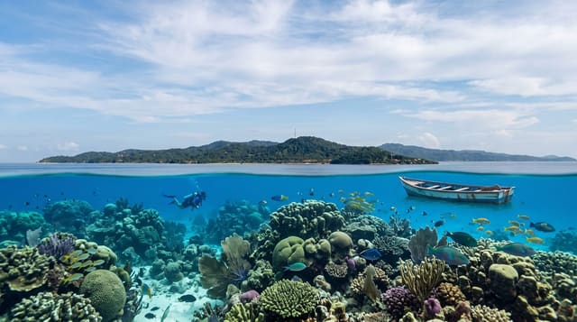
Urupukapuka Island
The largest island in the Bay of Islands, predator-free since 2009, walked on a loop between four bays.
Updated 21 October 2026
Urupukapuka is a two-hundred-hectare island of grassy headlands and sheltered white-sand bays, and it is the one island in the Bay of Islands set up for ordinary visitors to spend a day on. The archaeology is unusually visible: the whole island was occupied for centuries, and terraces, pits and pa sites are marked along the walking tracks, with interpretation panels that make the earthworks legible rather than leaving them as bumps in a paddock. Predators were removed in 2009 and the island is now pest-free, so birdlife is recovering. The Urupukapuka Island Archaeological Walk loops about five kilometres between Otehei Bay, where the ferry lands and there is a cafe, and the quieter bays beyond. Three DOC campsites sit behind beaches for anyone staying. Zane Grey based his 1920s big-game fishing camp at Otehei, which is why the bay has a lodge history out of proportion to its size.
History
The island was once home to the Ngare Raumati, one of the oldest tribes of the area, and its name is commonly taken to mean the island of many puka trees. In 1839 the whaling captain William Brind claimed to have bought 150 acres from the Ngāpuhi chief Rewa for a mare, and in 1927 Otehei Bay became the base of the American author Zane Grey's fishing expeditions (Wikipedia, Urupukapuka Island).
The landscape
- The archaeological loop - terraces and pa sites, signposted.
- The white-sand bays - Otehei, Cable, Urupukapuka and Sunset.
- The pest-free birdlife - recovering since the 2009 eradication.
- Otehei Bay - the landing point, cafe and Zane Grey history.
When to go
November to April. Camping needs booking through DOC. The last ferry back is early - check it before walking to the far bays.
Good to know
Only Otehei Bay has facilities; the rest of the island has none. Bags are checked for pests before boarding. The loop is exposed farmland walking with little shade. Ferries are weather-dependent.
Nearby
Cape Brett and the Hole in the Rock are further out; Paihia and Russell are on the mainland.
Key facts
Source: Wikidata, item Q4411108, read on 18 October 2026.
What to pack for Urupukapuka Island
Chosen from what this place is for. Tap a kit for the full checklist.
- Travel rod + reel - A packable multi-piece rod fits in a case and covers most holiday fishing. Find on Amazon
- Reef-safe sunscreen - High SPF that will not bleach the coral you are swimming over. Find on Amazon
- Binoculars - The single best wildlife tool - even a compact pair transforms a sighting. Find on Amazon
- Shelter suited to the place - Tent, tarp or hut booking - match it to the terrain and rules. Find on Amazon
Some links on this page are Amazon affiliate links - if you buy through them we may earn a small commission at no extra cost to you.
All packing kitsPlan your trip
Where to start if Urupukapuka Island is going on the list.
Booking links on this page are affiliate links - if you book through them we may earn a small commission at no extra cost to you. It never changes what we write about a place.
Opening times, ticket prices and seasonal closures change - check the official source before you go: official site.