The Afsluitdijk
The thirty-two kilometre barrier dam that closed off the Zuiderzee in 1932 and turned an arm of the sea into a lake.
Updated 29 August 2026
AI illustration
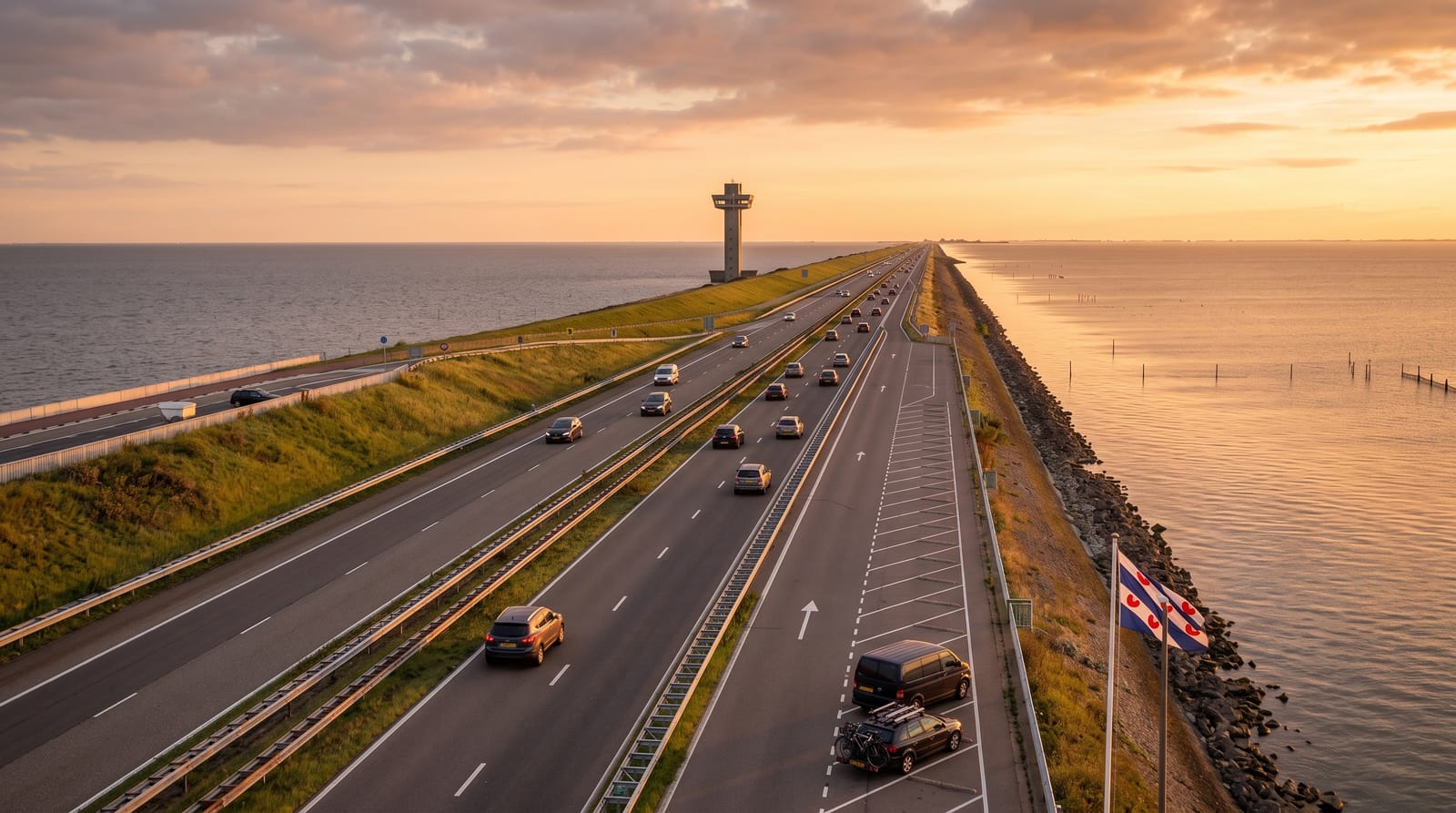
The Afsluitdijk is a straight line of stone and clay running for thirty-two kilometres across open water, and it changed the map of the country. Before it was closed in 1932 the Zuiderzee was an arm of the North Sea that flooded the towns around it; behind the dyke the water turned fresh within a few years and became the IJsselmeer, and the polders of Flevoland were later pumped dry out of its bed. Driving it takes about twenty minutes with grey water on both sides and no landmark except the sluice complexes at either end. At the point where the last gap was closed there is a monument with a viewing platform, reached by a stair over the road.
What to look for
- The Vlietermonument - the tower and viewing platform at the spot where the final gap was sealed in 1932.
- The sluice complexes - the locks and discharge sluices at Den Oever and Kornwerderzand, where ships pass and water is let out to the sea.
- The two waters - the Wadden Sea on one side and the flat freshwater IJsselmeer on the other, different in colour and swell.
- The scale of it - thirty-two kilometres of embankment with no land in sight for most of the way.
When to go
Any month works, since this is a drive rather than a season. Clear weather makes the difference: in mist there is nothing to see but the road. Upgrade works of recent years have moved traffic lanes and closed parts of the cycle path for long stretches, so check the current arrangements before planning to ride or walk it.
Practical notes
It is an engineering fact rather than a view, and plenty of people find the drive monotonous. There is no shelter on the dyke and the wind comes straight off the sea, which makes cycling hard work in the wrong direction. Long-running renovation works mean fencing, diversions and closed facilities in places. Stopping is only possible at the designated pull-offs.
Nearby
Harlingen and the ferries to the Wadden islands lie at the Frisian end, Den Oever and the North Holland polders at the other.
What to pack for The Afsluitdijk
Chosen from what this place is for. Tap a kit for the full checklist.
- Padded shorts - The one thing that makes a full day in the saddle bearable. Find on Amazon
- Comfortable walking shoes - Sightseeing means kilometres of pavement and cobbles daily. Find on Amazon
- Helmet - Bring your own if you have a good one; rentals vary wildly. Find on Amazon
- A slim anti-theft daypack - Zips that close properly; keep it in front in crowds and on transit. Find on Amazon
Some links on this page are Amazon affiliate links - if you buy through them we may earn a small commission at no extra cost to you.
All packing kitsPlan your trip
Where to start if The Afsluitdijk is going on the list.
Booking links on this page are affiliate links - if you book through them we may earn a small commission at no extra cost to you. It never changes what we write about a place.
Opening times, ticket prices and seasonal closures change - check the official source before you go: official site.