Waterberg Plateau
A sandstone table rising from the bush, used as a sanctuary where rare species were moved to breed in safety.
Updated 2 September 2026
AI illustration
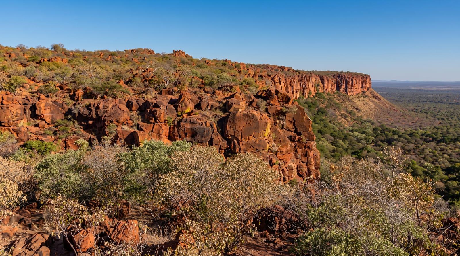
The Waterberg is a flat-topped sandstone massif standing two hundred metres above the surrounding bush, and the porous rock holds water that seeps out at the base, which is why the vegetation around it is unusually lush for Namibia. Its cliffs made the plateau a natural enclosure, and in the 1970s it was used as a sanctuary for species under pressure elsewhere, including white and black rhino, buffalo, sable and roan antelope, which were relocated here to breed. Access to the plateau itself is by guided drive only. Around the base, walking trails run through the woodland below the cliffs, which is unusual in a country where most wildlife viewing is from a vehicle, and the birding along the escarpment is excellent.
The landscape
- Guided plateau drives - the only way onto the top, where the relocated species live.
- Base trails - self-guided walks in the woodland beneath the cliffs.
- The escarpment birding - Cape vultures and rock-loving species along the cliffs.
- Sandstone formations - eroded red rock along the plateau edge.
When to go
May to October, the dry season, when animals concentrate near water and the weather is cool. The green season from December brings dramatic skies, more birds and thicker vegetation that hides mammals.
Practical notes
You cannot drive yourself onto the plateau, and the guided drives have set times and limited seats, so book on arrival or in advance. Sightings on top are far from guaranteed given the size of the area and the density of bush. The rest camp is state-run and functional rather than luxurious. It is also a place of considerable historical weight for Namibia, which the site interprets only lightly.
Nearby
Otjiwarongo and the cheetah conservation centres are nearby; Etosha lies northwest.
Key facts
Source: Wikidata, item Q1691293, read on 18 October 2026.
What to pack for Waterberg Plateau
Chosen from what this place is for. Tap a kit for the full checklist.
- Broken-in walking shoes or boots - Grip and ankle support matter more than looks; never hike in brand-new boots. Find on Amazon
- Binoculars - The single best wildlife tool - even a compact pair transforms a sighting. Find on Amazon
- Layers + a waterproof shell - Mountain weather turns fast; a packable rain jacket saves the day. Find on Amazon
- A zoom camera or long lens - Animals rarely come close; reach beats megapixels. Find on Amazon
Some links on this page are Amazon affiliate links - if you buy through them we may earn a small commission at no extra cost to you.
All packing kitsPlan your trip
Where to start if Waterberg Plateau is going on the list.
Booking links on this page are affiliate links - if you book through them we may earn a small commission at no extra cost to you. It never changes what we write about a place.
Opening times, ticket prices and seasonal closures change - check the official source before you go: official site.