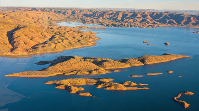
Lalla Takerkoust Lake
A reservoir forty minutes from Marrakech with the Atlas behind it, used for kayaking, quad tours and lakeside lunches.
Updated 29 August 2026
The dam at Lalla Takerkoust was built in the 1930s on the Nfis river to irrigate the Haouz plain and supply Marrakech with power, and the reservoir behind it sits in dry red hills with the High Atlas rising directly behind - which is why it became the city's nearest lake outing. What is there is a shore of restaurants and small lodges, pedalos, kayaks and paddleboards, jetskis in season, quad and buggy operators working the tracks around it, and camel rides; it is a commercial day-trip destination rather than a wild one, and it is honest to say so. The setting does the work, particularly late in the day when the light comes across the water onto the mountains. Water levels have dropped severely through the drought years of the 2020s, exposing wide margins of cracked bed, and in the worst years the lake has been a fraction of its capacity.
The landscape
- A 1930s reservoir - built to irrigate the Haouz plain and power Marrakech.
- The Atlas behind the water - the mountain wall directly across the lake.
- A day-trip shore - restaurants, kayaks, quads and camel rides.
- Drought margins - wide bands of exposed cracked bed in recent years.
When to go
Spring and autumn, late in the day. Half a day.
What to expect
Levels have fallen sharply in the drought years and the lake can be much reduced. It is commercial and busy at weekends. Quads and jetskis make noise across the water. Prices at the shore restaurants are Marrakech prices.
Nearby
The Kik plateau is on the ridge south; Amizmiz is west.
What to pack for Lalla Takerkoust Lake
Chosen from what this place is for. Tap a kit for the full checklist.
- Broken-in walking shoes or boots - Grip and ankle support matter more than looks; never hike in brand-new boots. Find on Amazon
- Quick-dry clothing - Board shorts or synthetics that shrug off spray and dry fast. Find on Amazon
- Layers + a waterproof shell - Mountain weather turns fast; a packable rain jacket saves the day. Find on Amazon
- Secure water shoes or reef boots - Grip on slippery launches and protection on rocky shores. Find on Amazon
Some links on this page are Amazon affiliate links - if you buy through them we may earn a small commission at no extra cost to you.
All packing kitsPlan your trip
Where to start if Lalla Takerkoust Lake is going on the list.
Booking links on this page are affiliate links - if you book through them we may earn a small commission at no extra cost to you. It never changes what we write about a place.
Opening times, ticket prices and seasonal closures change - check the official source before you go: official site.