Kapingamarangi Atoll
The southernmost atoll of Micronesia, Polynesian in language and culture.
Updated 16 October 2026
Kapingamarangi lies about a degree north of the equator, the southernmost point of the Federated States of Micronesia, and although it is administratively part of Pohnpei its people are Polynesian, speaking a language related to those of Tuvalu and Tokelau rather than to Pohnpeian. Around thirty islets ring the lagoon. Carving in wood and shell is the atoll's known craft.
Background
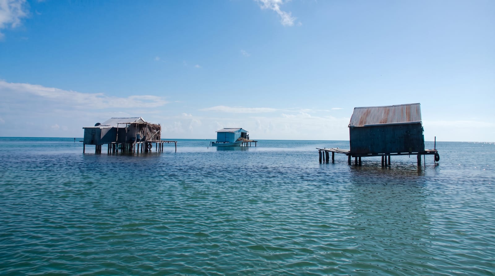
Kapingamarangi is both an atoll and a municipality of Pohnpei state. It lies 300 kilometres south of Nukuoro and 740 kilometres southwest of Pohnpei island. With its lagoon the atoll covers 74 square kilometres, but only 1.1 square kilometres is land, spread across 33 wooded islets on the eastern side. About 500 people lived there in 2007, on three of the islets, mostly Touhou and Welua, which a causeway joins. The western reef rim almost disappears at high water. A Spanish expedition under Hernando de Grijalva recorded it in 1537 as Los Pescadores, and no European ship sailed into the lagoon until 1877.
Source: Wikipedia, "Kapingamarangi"
What to look for
- The Polynesian community - language and culture distinct from the rest of the country.
- The lagoon - around thirty islets around a large enclosed water.
- The carving - the wood and shell work the atoll is known for.
- The equatorial position - the southernmost point in the country.
When to go
December to March is the drier season. The supply ship runs every few weeks at best. Getting there and back can take a month.
Good to know
There is no air service; the only access is a supply ship taking several days each way and running irregularly. Visitors stay with families. This is a serious commitment of time and should be arranged well ahead.
Nearby
Nukuoro is north, and Pohnpei is far north.
Key facts
Source: Wikidata, item Q388347, read on 18 October 2026.
What to pack for Kapingamarangi Atoll
Chosen from what this place is for. Tap a kit for the full checklist.
- Reef-safe sunscreen - High SPF that will not bleach the coral you are swimming over. Find on Amazon
- Comfortable walking shoes - Sightseeing means kilometres of pavement and cobbles daily. Find on Amazon
- Shelter suited to the place - Tent, tarp or hut booking - match it to the terrain and rules. Find on Amazon
- Quick-dry towel - A microfibre towel packs small and dries in minutes. Find on Amazon
Some links on this page are Amazon affiliate links - if you buy through them we may earn a small commission at no extra cost to you.
All packing kitsPlan your trip
Where to start if Kapingamarangi Atoll is going on the list.
Booking links on this page are affiliate links - if you book through them we may earn a small commission at no extra cost to you. It never changes what we write about a place.
Opening times, ticket prices and seasonal closures change - check the official source before you go: official site.