Lake Resia
A bell tower standing alone in a reservoir, all that shows of two villages flooded in 1950.
Updated 19 October 2026
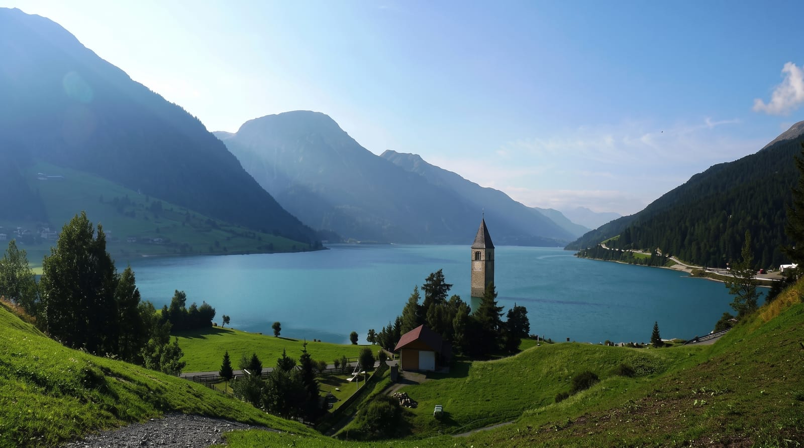
AI illustration
A hydroelectric scheme completed in 1950 raised the water level and merged two natural lakes into one reservoir, flooding much of the villages of Curon and Resia; around a hundred and sixty homes were submerged and their inhabitants resettled in a new village built above the shore. The fourteenth-century bell tower of the old church was protected as a monument and left standing, and it now rises from the water a short way offshore, the only visible trace. In hard winters the reservoir freezes and the tower can be reached on foot across the ice. The lake is used for kitesurfing in summer because of steady winds.
History
Plans for a smaller artificial lake, 5 m deep, date from 1920, and in July 1939 the Montecatini company put forward a plan for a lake 22 m deep that would join two natural lakes. The steeple of the submerged 14th-century church can be reached on foot when the water freezes, and legend says its bells can still be heard in winter (Wikipedia, Reschensee).
What you'll find
- The bell tower - a fourteenth-century tower standing in open water.
- The reservoir - two natural lakes merged by the 1950 scheme.
- The new village - Curon rebuilt above the shoreline after the flooding.
- The winter ice - a frozen surface that can be walked in cold years.
When to go
June to September for the lake and kitesurfing; deep winter for the frozen surface, though ice conditions vary year to year and are not guaranteed or supervised.
Things to know
The site is one tower and a shoreline, seen quickly. Walking on the ice is unsupervised and conditions change. The pass road carries heavy traffic.
Nearby
Glorenza lies down the valley; the Swiss and Austrian borders are close.
Key facts
Source: Wikidata, item Q1249840, read on 18 October 2026.
What to pack for Lake Resia
Chosen from what this place is for. Tap a kit for the full checklist.
- Quick-dry clothing - Board shorts or synthetics that shrug off spray and dry fast. Find on Amazon
- Warm base layers - Merino or synthetic against the skin - never cotton, which chills when damp. Find on Amazon
- Comfortable walking shoes - Sightseeing means kilometres of pavement and cobbles daily. Find on Amazon
- Secure water shoes or reef boots - Grip on slippery launches and protection on rocky shores. Find on Amazon
Some links on this page are Amazon affiliate links - if you buy through them we may earn a small commission at no extra cost to you.
All packing kitsPlan your trip
Where to start if Lake Resia is going on the list.
Booking links on this page are affiliate links - if you book through them we may earn a small commission at no extra cost to you. It never changes what we write about a place.
Opening times, ticket prices and seasonal closures change - check the official source before you go: official site.