Civita di Bagnoregio
A village on an eroding pinnacle of tufa reached only by a footbridge, with a permanent population in single figures.
Updated 19 October 2026
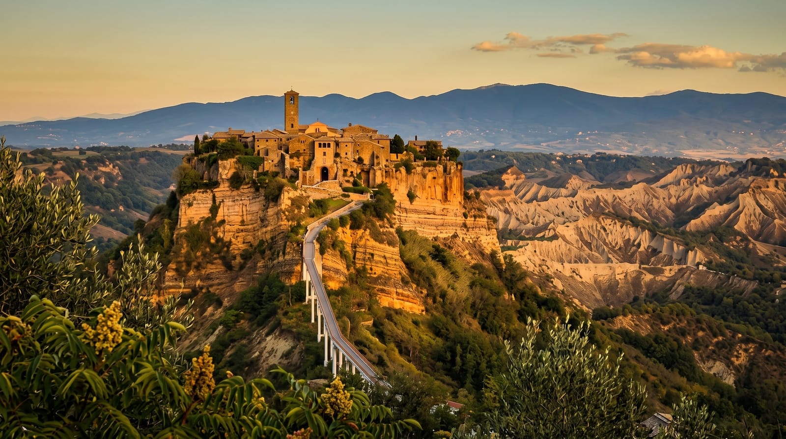
AI illustration
Civita sits on a column of tufa above a valley of eroding clay, and the ground around it has been falling away for centuries: the road, the approach and much of the original village have gone into the ravine, and what is left is reached by a concrete footbridge built in 1965. It is called the dying town, which is accurate; the permanent population is in single figures. The village itself is a handful of stone lanes, an Etruscan gate, a small church and a great deal of view. The clay badlands around it, the calanchi, are eroding at a rate that the engineering works have slowed rather than stopped.
History
Civita was founded by the Etruscans more than 2,500 years ago and once had five city gates, of which only the Porta Santa Maria, or Porta Cava, is still used. Its only access is a footbridge from the nearby town, with a toll introduced in 2013 (Wikipedia, Civita di Bagnoregio).
What to look for
- The footbridge - the only way in, three hundred metres of concrete ramp.
- The calanchi - the eroding clay badlands around the pinnacle.
- The Etruscan gate - the original entrance cut through the rock.
- The lanes - the surviving fragment of the village.
When to go
April to June and September to October. Early morning and evening are when the light on the pinnacle works and the coach groups are absent. It takes half a day including the walk. Winter fog in the valley is atmospheric.
Before you go
The bridge is a steep three-hundred-metre climb with no shade and is hard work in heat. There is a toll to cross. The village takes forty minutes to walk and is now almost entirely restaurants and shops for visitors, with a handful of residents. Coach parties fill it through the middle of the day.
Nearby
Orvieto is half an hour north; Lake Bolsena is nearby.
Key facts
Source: Wikidata, item Q431470, read on 18 October 2026.
What to pack for Civita di Bagnoregio
Chosen from what this place is for. Tap a kit for the full checklist.
- Comfortable walking shoes - Sightseeing means kilometres of pavement and cobbles daily. Find on Amazon
- A slim anti-theft daypack - Zips that close properly; keep it in front in crowds and on transit. Find on Amazon
- A refillable water bottle - Many cities have public fountains; save money and plastic. Find on Amazon
- A light layer + compact umbrella - For museum air-con and a sudden shower. Find on Amazon
Some links on this page are Amazon affiliate links - if you buy through them we may earn a small commission at no extra cost to you.
All packing kitsPlan your trip
Where to start if Civita di Bagnoregio is going on the list.
Booking links on this page are affiliate links - if you book through them we may earn a small commission at no extra cost to you. It never changes what we write about a place.
Opening times, ticket prices and seasonal closures change - check the official source before you go: official site.