Khangchendzonga National Park
A Sikkim park rising from subtropical valleys to glaciers below the world's third highest mountain, crossed only on multi-day treks.
Updated 4 September 2026
AI illustration
UNESCO World Heritage
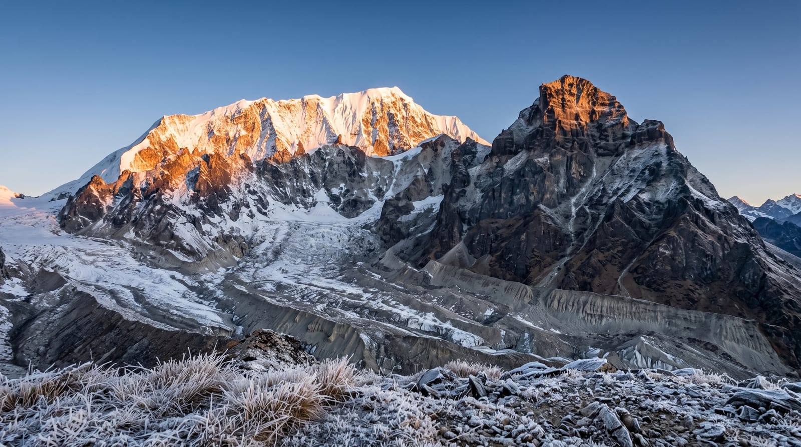
Khangchendzonga National Park covers a large part of Sikkim, rising from subtropical valleys through rhododendron and fir forest to glaciers and the flanks of the world's third highest mountain. Almost all of it is walked rather than driven. The best known route starts at Yuksom and climbs over several days through forest and yak pasture to Dzongri and Goecha La, where the east face of the mountain stands across a glacier at sunrise. Lower down there are red panda, Himalayan black bear and blood pheasant in the forest, though sightings are uncommon. Permits, a registered guide and a support crew are required, and the peak is treated as sacred ground by Sikkimese communities.
What you'll find
- The Goecha La viewpoint - the pass looking across the glacier to the east face of the mountain.
- Dzongri ridge - high yak pasture with a wide arc of Himalayan peaks.
- Rhododendron forest - dense flowering woodland on the lower stages of the trek.
- Glaciers and moraine - the ice and rubble fields below the high peaks.
When to go
Two windows work: March to May, when rhododendrons flower but haze can build through the day, and October to November, which gives the clearest mountain views and cold, stable weather. The monsoon from June to September brings rain, leeches and closed views, and deep winter snow blocks the high passes. Permits and guides must be arranged before you reach Yuksom.
Things to know
This is a real trek, not a walk. Days are long, the climb from Yuksom is relentless, and Dzongri and Goecha La sit high enough that altitude sickness is common; several people turn back each season. Camps are basic and cold and there are no lodges on the upper route. Cloud can hide the mountain entirely for days, and trekking without a registered guide is not permitted.
Nearby
The monasteries and old capital sites at Pelling and Tashiding are within a few hours of the trailhead.
Key facts
Source: Wikidata, item Q2605019, read on 18 October 2026.
What to pack for Khangchendzonga National Park
Chosen from what this place is for. Tap a kit for the full checklist.
- Broken-in walking shoes or boots - Grip and ankle support matter more than looks; never hike in brand-new boots. Find on Amazon
- Binoculars - The single best wildlife tool - even a compact pair transforms a sighting. Find on Amazon
- Warm base layers - Merino or synthetic against the skin - never cotton, which chills when damp. Find on Amazon
- Strong insect repellent - DEET or picaridin; the jungle is where bites and disease risk are highest. Find on Amazon
Some links on this page are Amazon affiliate links - if you buy through them we may earn a small commission at no extra cost to you.
All packing kitsPlan your trip
Where to start if Khangchendzonga National Park is going on the list.
Booking links on this page are affiliate links - if you book through them we may earn a small commission at no extra cost to you. It never changes what we write about a place.
Opening times, ticket prices and seasonal closures change - check the official source before you go: official site.