Amrum
An island with a sand bank in front of it up to two kilometres wide, one of the largest beaches in Europe.
Updated 4 September 2026

AI illustration
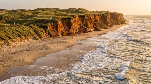
Amrum is about twenty square kilometres, but in front of its western shore lies the Kniepsand, a sand bank that has migrated against the island and is up to two kilometres wide and ten long, giving one of the largest beaches in Europe by area. Behind it stand dunes rising over thirty metres. The island lies in the Wadden Sea national park, and the mudflats to the east are crossed on guided walks at low tide. The lighthouse of 1875 is a tower of about forty-two metres set high on a dune, which lifts its light some sixty-three metres above the sea - higher than any other on the German North Sea coast. Frisian is still spoken by part of the population, and old sea captains' graves stand in the churchyard.
What you'll find
- The Kniepsand - a sand bank up to two kilometres wide against the shore.
- The 1875 lighthouse - its dune-top light the highest on the German North Sea coast.
- The talking gravestones - captains' graves carved with their life stories.
- The Frisian language - still spoken by part of the island population.
When to go
May to September; ferries run to tide-dependent timetables and are cancelled in storms. Mudflat walks must be guided. Winter services are minimal.
Practical notes
Getting there takes two ferries or a long crossing and is tide-bound. The beach is vast but exposed and windy. The North Sea is cold.
Nearby
Föhr lies east; the Halligen are north.
What to pack for Amrum
Chosen from what this place is for. Tap a kit for the full checklist.
- Reef-safe sunscreen - High SPF that will not bleach the coral you are swimming over. Find on Amazon
- Loose, light, long clothing - Covering up beats bare skin in the desert - and locals dress this way for a reason. Find on Amazon
- Quick-dry towel - A microfibre towel packs small and dries in minutes. Find on Amazon
- A wide-brim hat + sunglasses - Shade for your face and eyes where there is none overhead. Find on Amazon
Some links on this page are Amazon affiliate links - if you buy through them we may earn a small commission at no extra cost to you.
All packing kitsPlan your trip
Where to start if Amrum is going on the list.
Booking links on this page are affiliate links - if you book through them we may earn a small commission at no extra cost to you. It never changes what we write about a place.
Opening times, ticket prices and seasonal closures change - check the official source before you go: official site.