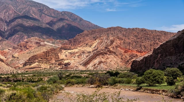
Wadi Degla Protectorate
A limestone canyon on the eastern edge of Cairo, cut by an ancient river and used by the city as a running and cycling route.
Updated 31 August 2026
The wadi runs about thirty kilometres east from the edge of Maadi into the Eastern Desert, a dry valley cut through Eocene limestone by water that stopped flowing a very long time ago, with walls up to fifty metres and a flat gravel floor that makes for easy walking. It was declared a protected area in 1999 and it works as Cairo's nearest piece of open desert: runners and cyclists use the first few kilometres constantly, and beyond that the traffic thins to almost nothing. Marine fossils are visible in the rock, evidence of the sea that laid the limestone down. Foxes, gazelle and rock hyrax are present although sightings are a matter of luck and timing. Flash floods still come through occasionally in winter and rearrange the floor.
The landscape
- Fifty-metre limestone walls - a dry canyon at the city edge.
- Marine fossils in the rock - shells from the sea that made the limestone.
- A flat gravel floor - straightforward walking and riding for kilometres.
- Desert wildlife - foxes and hyrax, with gazelle further in.
When to go
October to April, and early morning or late afternoon even then. Fridays bring Cairo runners and cyclists in numbers to the first stretch. Half a day gets you well into the quiet section. Avoid days with rain forecast because of flash flood risk.
What to expect
The first kilometres near the gate are littered and heavily used. There is no water, shade or shelter beyond the entrance, and phone signal fails quickly. Summer is genuinely dangerous here. Wildlife sightings are rare and should not be the reason for the trip.
Nearby
Maadi is at the mouth of the wadi; the Eastern Desert opens out to the east.
Key facts
Source: Wikidata, item Q12241414, read on 18 October 2026.
What to pack for Wadi Degla Protectorate
Chosen from what this place is for. Tap a kit for the full checklist.
- Broken-in walking shoes or boots - Grip and ankle support matter more than looks; never hike in brand-new boots. Find on Amazon
- Padded shorts - The one thing that makes a full day in the saddle bearable. Find on Amazon
- Binoculars - The single best wildlife tool - even a compact pair transforms a sighting. Find on Amazon
- Loose, light, long clothing - Covering up beats bare skin in the desert - and locals dress this way for a reason. Find on Amazon
Some links on this page are Amazon affiliate links - if you buy through them we may earn a small commission at no extra cost to you.
All packing kitsPlan your trip
Where to start if Wadi Degla Protectorate is going on the list.
Booking links on this page are affiliate links - if you book through them we may earn a small commission at no extra cost to you. It never changes what we write about a place.
Opening times, ticket prices and seasonal closures change - check the official source before you go: official site.