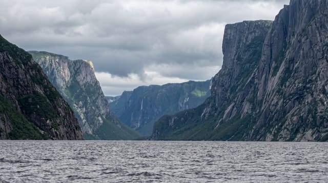
Lago Ranco
A lake of many islands in the southern lake district, quieter than Llanquihue and much less built on.
Updated 19 October 2026
Lago Ranco covers around 400 square kilometres and holds a scatter of islands, the largest being Huapi, which has a Mapuche Huilliche community on it reached by a small ferry. The lake sits below the Andes with Puyehue and Casablanca visible on a clear day, and the circuit road around it - about a hundred kilometres, part paved and part gravel - passes small settlements, the Nilahue falls at its eastern end, and stretches of native forest. It is markedly less developed than Llanquihue or Villarrica, which is the reason to go, though holiday building on the shore has been increasing.
History
The Ranco basin has been Huilliche country since ancient times: the communities around Lake Ranco and Lake Maihue, joined by the Calcurrupe River, lived by gathering, hunting, fishing, livestock and early farming, and the names they gave, such as Huapi, Calcurrupe, Llifén and Riñinahue, are still in use. In colonial times the area stayed outside Spanish settlement apart from Jesuit missions sent from the forts of Quinchilca and San José de Alcudia; Bernardo Philippi mapped the province of Valdivia in 1846, and the first colonists reached the western shore of the lake in the late 19th century (Wikipedia, Lago Ranco, Chile).
Highlights
- A lake of about 400 square kilometres - with a scatter of islands.
- Huapi island - with a Huilliche community, reached by ferry.
- A circuit road of about a hundred kilometres - part paved, part gravel.
- The Nilahue falls - at the eastern end of the lake.
When to go
December to March. A full day for the circuit.
What to expect
Parts of the circuit are gravel and slow. Services around the lake are limited and seasonal. Rain is frequent. The islands need boats and the ferry to Huapi runs to a local schedule.
Nearby
Futrono is on the northern shore; Puyehue park is south-east.
What to pack for Lago Ranco
Chosen from what this place is for. Tap a kit for the full checklist.
- Travel rod + reel - A packable multi-piece rod fits in a case and covers most holiday fishing. Find on Amazon
- Reef-safe sunscreen - High SPF that will not bleach the coral you are swimming over. Find on Amazon
- A small tackle selection - Hooks, weights, line and a few lures or flies suited to local waters. Find on Amazon
- Quick-dry towel - A microfibre towel packs small and dries in minutes. Find on Amazon
Some links on this page are Amazon affiliate links - if you buy through them we may earn a small commission at no extra cost to you.
All packing kitsPlan your trip
Where to start if Lago Ranco is going on the list.
Booking links on this page are affiliate links - if you book through them we may earn a small commission at no extra cost to you. It never changes what we write about a place.
Opening times, ticket prices and seasonal closures change - check the official source before you go: official site.