Cerro Castillo National Park
A basalt crown of spires above a glacial lagoon, walked as the Carretera Austral's answer to Torres del Paine.
Updated 19 October 2026
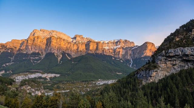
Cerro Castillo takes its name from the shape: a ring of basalt spires on the summit ridge that reads as a castle wall, with a glacier hanging below it and a milky turquoise lagoon at its foot. The traverse from Las Horquetas to Villa Cerro Castillo takes three to four days over several passes, or the lagoon can be reached and returned from in one long day. It was upgraded from a reserve to a national park in 2018 as part of the Route of Parks initiative, and it gets compared to Torres del Paine constantly - fairly on the rock, less so on the infrastructure, which is far thinner here.
History
Cerro Castillo was made a national reserve in 1970, and in 2018 it became a national park under an agreement between the Chilean government and Tompkins Conservation (Wikipedia, Cerro Castillo National Park).
What's there
- A crown of basalt spires - the castle wall the mountain is named for.
- A hanging glacier below the ridge - and a turquoise lagoon under it.
- A three to four day traverse - or a long day to the lagoon.
- A national park since 2018 - upgraded from reserve status.
When to go
December to March; the passes hold snow outside that. Two to four days.
What to expect
Registration is required and the traverse must be walked in the permitted direction with set camps. Weather changes violently and the passes are exposed. There are no refuges - it is tents. River crossings can be difficult.
Nearby
Coyhaique is north; Puerto Rio Tranquilo and the lake are south.
Key facts
Source: Wikidata, item Q3738207, read on 18 October 2026.
What to pack for Cerro Castillo National Park
Chosen from what this place is for. Tap a kit for the full checklist.
- Broken-in walking shoes or boots - Grip and ankle support matter more than looks; never hike in brand-new boots. Find on Amazon
- Reef-safe sunscreen - High SPF that will not bleach the coral you are swimming over. Find on Amazon
- Binoculars - The single best wildlife tool - even a compact pair transforms a sighting. Find on Amazon
- Warm base layers - Merino or synthetic against the skin - never cotton, which chills when damp. Find on Amazon
Some links on this page are Amazon affiliate links - if you buy through them we may earn a small commission at no extra cost to you.
All packing kitsPlan your trip
Where to start if Cerro Castillo National Park is going on the list.
Booking links on this page are affiliate links - if you book through them we may earn a small commission at no extra cost to you. It never changes what we write about a place.
Opening times, ticket prices and seasonal closures change - check the official source before you go: official site.