Thaidene Nëné
A park established at the insistence of the Łutsël K'é Dene, who spent nearly two decades negotiating its terms.
Updated 19 October 2026

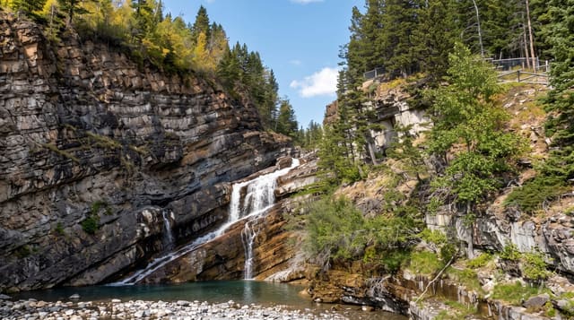
AI illustration
Thaidene Nëné means the land of the ancestors in Denesuline, and the park exists because the Łutsël K'é Dene First Nation spent nearly two decades, from 2001, negotiating terms they would accept: they rejected an earlier Parks Canada proposal in the 1970s and only agreed in 2019 to an arrangement in which the nation co-governs the area and Dene harvesting rights continue. It protects around fourteen thousand square kilometres around the East Arm of Great Slave Lake, where the Canadian Shield meets the lake in cliffs up to two hundred metres. There are no roads, trails or facilities; access is by float plane or boat from Yellowknife.
History
A national park of 7,340 square kilometres was considered here but withdrawn in 1970, and in 2001 the Łutsël K'é Dene First Nation took up the idea again; a feasibility study followed from 2002 to 2004, a memorandum of understanding with Parks Canada in 2006 widened the area under study, and the Northwest Territories took control of the study area in 2014. The First Nation voted for the park on 15 February 2019, and on 21 August 2019 Parks Canada, the territorial government and three First Nations signed the agreement creating a national park reserve of 14,305 square kilometres beside a territorial area that includes a wildlife conservation area (Wikipedia, Thaidene Nëné National Park Reserve).
Highlights
- The East Arm cliffs - Shield rock rising two hundred metres from deep water.
- The Dene co-governance - a park established on the nation's own terms.
- The barrenland transition - boreal forest giving way to tundra.
- The undeveloped scale - fourteen thousand square kilometres without roads.
When to go
July to September, once ice clears Great Slave Lake and before it returns; the window is short. Access is by charter and weather cancels flights regularly.
Things to know
There is no road, no trail network and no facilities. Charters are expensive and weather-dependent. Great Slave Lake is deep, cold and gets dangerously rough.
Nearby
Yellowknife is the staging point; Łutsël K'é is the community in the park.
Key facts
Source: Wikidata, item Q724310, read on 18 October 2026.
What to pack for Thaidene Nëné
Chosen from what this place is for. Tap a kit for the full checklist.
- Broken-in walking shoes or boots - Grip and ankle support matter more than looks; never hike in brand-new boots. Find on Amazon
- Binoculars - The single best wildlife tool - even a compact pair transforms a sighting. Find on Amazon
- Warm base layers - Merino or synthetic against the skin - never cotton, which chills when damp. Find on Amazon
- Layers + a waterproof shell - Mountain weather turns fast; a packable rain jacket saves the day. Find on Amazon
Some links on this page are Amazon affiliate links - if you buy through them we may earn a small commission at no extra cost to you.
All packing kitsPlan your trip
Where to start if Thaidene Nëné is going on the list.
Booking links on this page are affiliate links - if you book through them we may earn a small commission at no extra cost to you. It never changes what we write about a place.
Opening times, ticket prices and seasonal closures change - check the official source before you go: official site.