Rouge National Urban Park
Canada's first national urban park, holding working farms and a Carolinian forest inside Toronto's edge.
Updated 19 October 2026

AI illustration
Rouge was established in 2015 as Canada's first national urban park, covering around seventy-nine square kilometres at the eastern edge of Toronto, reachable by public transit from a city of six million. It is unusual in what it protects: not wilderness but a working landscape, with about seventy-five family farms on some of the best agricultural land in the country continuing to operate inside the park, alongside Carolinian forest, wetlands and a Lake Ontario beach. Archaeological sites in the valley go back around ten thousand years, and it holds one of the largest concentrations of pre-contact Iroquoian village sites in the region.
History
Meltwater from glaciers 12,000 years ago formed ancestral Lake Ontario over this area, and people have lived here for over 10,000 years, from nomadic hunters to Iroquoian farmers; the Rouge was a branch of the Toronto Carrying-Place Trail, the portage linking Lake Ontario to Lake Simcoe, designated a National Historic Event in 1969, and Bead Hill, an intact 17th-century Seneca village, became a National Historic Site in 1991. The Group of Seven painter F. H. Varley painted the banks of the Rouge in the 1950s, and since 2011 Parks Canada has worked to turn the original Rouge Park into a national urban park of 79.1 square kilometres (Wikipedia, Rouge National Urban Park).
What's there
- The working farms - about seventy-five farms operating inside a national park.
- The Carolinian forest - a southern forest type at its Canadian limit.
- The Rouge Beach - a Lake Ontario beach and marsh at the river mouth.
- The archaeological record - ten thousand years of occupation in the valley.
When to go
April to October for trails and the beach; the park is open year-round and used for snowshoeing. Autumn colour in the Carolinian forest is strong. Transit access works from central Toronto.
Before you go
The park is fragmented by roads, rail and a hydro corridor, so it does not feel like wilderness. Trailheads are scattered and parking is limited. Farm land is private and not open to walk across.
Nearby
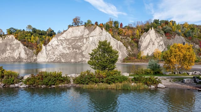
The Scarborough Bluffs lie west; Toronto is beyond them.
Key facts
Source: Wikidata, item Q26810464, read on 18 October 2026.
What to pack for Rouge National Urban Park
Chosen from what this place is for. Tap a kit for the full checklist.
- Broken-in walking shoes or boots - Grip and ankle support matter more than looks; never hike in brand-new boots. Find on Amazon
- Warm base layers - Merino or synthetic against the skin - never cotton, which chills when damp. Find on Amazon
- Layers + a waterproof shell - Mountain weather turns fast; a packable rain jacket saves the day. Find on Amazon
- An insulated + windproof jacket - A down or synthetic layer under a hard shell handles most cold. Find on Amazon
Some links on this page are Amazon affiliate links - if you buy through them we may earn a small commission at no extra cost to you.
All packing kitsPlan your trip
Where to start if Rouge National Urban Park is going on the list.
Booking links on this page are affiliate links - if you book through them we may earn a small commission at no extra cost to you. It never changes what we write about a place.
Opening times, ticket prices and seasonal closures change - check the official source before you go: official site.