Iqaluit
The capital of Nunavut, a city of about eight thousand with no road connecting it to anywhere else.
Updated 19 October 2026

AI illustration
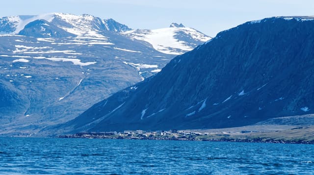
Iqaluit became the capital when Nunavut was created in 1999 as the outcome of the largest Indigenous land claim settlement in Canadian history, creating a territory that covers about a fifth of Canada's land area. The city has around eight thousand people, no road to anywhere else, and everything not flown in arrives by sealift during the few ice-free weeks. The legislative assembly chamber is arranged as a circle with a mace incorporating narwhal tusk and Inuit carving, and it operates by consensus government without political parties. The Nunatta Sunakkutaangit Museum holds Inuit art, and printmaking and carving are major local industries.
History
Inuit and their predecessors, the Dorset and Thule peoples, fished here for thousands of years, and the name means place of many fish. An airfield built in 1942 brought the first newcomers, and the town's first permanent resident was Nakasuk, an Inuk guide who helped choose the flat ground for the landing strip; known as Frobisher Bay after the bay it stands on, the town grew through the 1950s into the administrative centre for much of the eastern Arctic, held its first community council elections in 1964, took back its Inuktitut name in 1987 and was named capital of Nunavut in 1999 (Wikipedia, Iqaluit).
What you'll find
- The legislative assembly - a consensus chamber with a narwhal tusk mace.
- The sealift economy - a year's supplies delivered in a few ice-free weeks.
- The Inuit art - carving and printmaking in galleries and the museum.
- Sylvia Grinnell park - tundra and a river at the edge of the city.
When to go
July to September for open water, the least cold and the sealift; winter offers aurora and dog sledding but temperatures reach minus fifty with wind. Flights are expensive year-round.
Practical notes
Flights and accommodation are extremely expensive, and food prices are among the highest in Canada. There are no roads out of the city. Weather cancels flights for days.
Nearby
Pangnirtung lies north on Baffin Island; the rest of Nunavut is by air.
Key facts
Source: Wikidata, item Q2030, read on 18 October 2026.
What to pack for Iqaluit
Chosen from what this place is for. Tap a kit for the full checklist.
- Spare batteries + cards - Cold and long shoots drain power; never run out at the good light. Find on Amazon
- Warm base layers - Merino or synthetic against the skin - never cotton, which chills when damp. Find on Amazon
- Comfortable walking shoes - Sightseeing means kilometres of pavement and cobbles daily. Find on Amazon
- Swimwear - Needed at most public thermal pools; some traditional baths are nude and single-sex. Find on Amazon
Some links on this page are Amazon affiliate links - if you buy through them we may earn a small commission at no extra cost to you.
All packing kitsPlan your trip
Where to start if Iqaluit is going on the list.
Booking links on this page are affiliate links - if you book through them we may earn a small commission at no extra cost to you. It never changes what we write about a place.
Opening times, ticket prices and seasonal closures change - check the official source before you go: official site.