Atlin
A gold-rush village on British Columbia's largest natural lake, reached only by driving through the Yukon.
Updated 19 October 2026
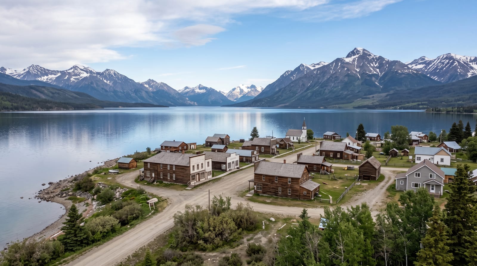
AI illustration
Atlin sits in the far northwest corner of British Columbia, and the only road to it comes from Whitehorse in the Yukon, which is a fair summary of how remote it is. Gold was found in 1898 and thousands arrived; a few hundred people live there now. Atlin Lake is the largest natural lake in the province, deep and glacier-fed, with the Llewellyn Glacier at its southern end in Atlin Provincial Park. The Tarahne, a passenger boat launched in 1917, sits restored on the shore. The setting drew painters, and the light and mountains gave the village a reputation among artists that it keeps.
History
The Taku River Tlingit have long used the lake, whose name comes from their words for big body of water, and the first European to see it is thought to have been Michael Byrne of the Western Union Telegraph Company, in 1867. Frederick Miller and Kenneth McLaren staked claims on Pine Creek in 1898, starting one of the richest offshoots of the Klondike rush, with some 5,000 people here by the end of 1899; in the 1920s Atlin drew tourists by boat and lake steamer as the Switzerland of the North, and the road from the Yukon was built only in 1949 (Wikipedia, Atlin, British Columbia).
Highlights
- Atlin Lake - the largest natural lake in British Columbia, glacier-fed.
- The MV Tarahne - a 1917 lake steamer restored on the foreshore.
- The gold rush village - wooden buildings from the 1898 boom.
- The Llewellyn Glacier - ice at the lake's southern end in the park.
When to go
June to September; winter is severe and services shut. The road from Whitehorse is gravel in sections. Northern light in June means almost no darkness.
Before you go
Access is only through the Yukon, which surprises people planning from within BC. Services are minimal with limited fuel and accommodation. Winter is long and most of the village closes.
Nearby
Whitehorse lies north in the Yukon; the Alaska Highway runs past it.
Key facts
Source: Wikidata, item Q2623078, read on 18 October 2026.
What to pack for Atlin
Chosen from what this place is for. Tap a kit for the full checklist.
- Warm base layers - Merino or synthetic against the skin - never cotton, which chills when damp. Find on Amazon
- Comfortable walking shoes - Sightseeing means kilometres of pavement and cobbles daily. Find on Amazon
- An insulated + windproof jacket - A down or synthetic layer under a hard shell handles most cold. Find on Amazon
- A slim anti-theft daypack - Zips that close properly; keep it in front in crowds and on transit. Find on Amazon
Some links on this page are Amazon affiliate links - if you buy through them we may earn a small commission at no extra cost to you.
All packing kitsPlan your trip
Where to start if Atlin is going on the list.
Booking links on this page are affiliate links - if you book through them we may earn a small commission at no extra cost to you. It never changes what we write about a place.
Opening times, ticket prices and seasonal closures change - check the official source before you go: official site.