Foz do Sao Francisco
Where Brazil's great interior river meets the Atlantic between dunes, with a lighthouse and an abandoned village behind it.
Updated 29 August 2026
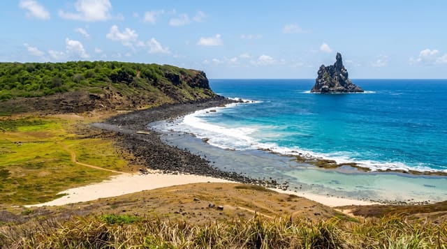
The Sao Francisco runs two thousand eight hundred kilometres from Minas Gerais through the dry interior before reaching the sea here, on the line between Alagoas and Sergipe, and the mouth is a shifting arrangement of sandbars, dunes and channels rather than a fixed opening. Boats run from Piacabucu down the last stretch, and buggies cross the dunes on the Alagoas side to the point where fresh water and salt water meet, a visible line in some conditions. The Cabeco lighthouse stands offshore in the water, half swallowed - the village of Cabeco behind it was abandoned as the sea advanced, a change local people connect to the sediment held back by the dams upstream. Mangrove channels and coconut groves line the approach.
What you'll find
- The mouth of the Sao Francisco - the end of a 2,800 km river across dry Brazil.
- The drowned Cabeco lighthouse - standing in the sea off an abandoned village.
- Shifting dunes and sandbars - the mouth rearranging itself rather than fixed.
- The fresh and salt water line - visible where the river meets the Atlantic.
When to go
September to March. A day.
Before you go
Access is by boat and buggy, both weather dependent. The site is exposed with no shade. What you see changes with the sandbars, so photographs from other years may not match. There is little infrastructure at the mouth itself.
Nearby
Penedo is upriver in Alagoas; Aracaju is south in Sergipe.
What to pack for Foz do Sao Francisco
Chosen from what this place is for. Tap a kit for the full checklist.
- Broken-in walking shoes or boots - Grip and ankle support matter more than looks; never hike in brand-new boots. Find on Amazon
- Loose, light, long clothing - Covering up beats bare skin in the desert - and locals dress this way for a reason. Find on Amazon
- Layers + a waterproof shell - Mountain weather turns fast; a packable rain jacket saves the day. Find on Amazon
- A wide-brim hat + sunglasses - Shade for your face and eyes where there is none overhead. Find on Amazon
Some links on this page are Amazon affiliate links - if you buy through them we may earn a small commission at no extra cost to you.
All packing kitsPlan your trip
Where to start if Foz do Sao Francisco is going on the list.
Booking links on this page are affiliate links - if you book through them we may earn a small commission at no extra cost to you. It never changes what we write about a place.
Opening times, ticket prices and seasonal closures change - check the official source before you go: official site.