Salza River
An undammed Styrian river running turquoise out of karst springs, rafted and kayaked along its whole length.
Updated 29 August 2026
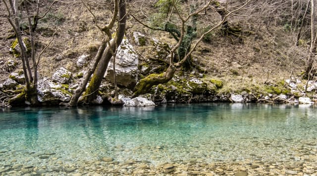
The Salza runs about eighty kilometres from the Mariazell area east to join the Enns at Grossreifling, and it is unusual in the Alps for being essentially unregulated - no dams, no reservoirs, no straightened channel - so it still moves gravel, cuts new banks and floods its bed the way an alpine river is supposed to. The water comes largely from karst springs in the Hochschwab massif, which is why it holds a strong turquoise colour and stays cold and clear, and the same springs supply a large part of Vienna's drinking water through the second Vienna water main, built from Wildalpen in the 1900s. Rafting and kayaking run the whole length in grades from easy to demanding, and the road along the valley is a well-known motorcycling route.
The landscape
- An undammed alpine river - still shifting its own gravel and banks.
- Turquoise karst water - fed by springs out of the Hochschwab.
- Rafting and kayaking - runs from easy to demanding along the valley.
- The Vienna water main - the 1900s pipeline taking these springs to the city.
When to go
May to September; highest water in spring snowmelt. A day.
Before you go
The water is very cold - wetsuits are standard even in summer. Levels change fast and trips are cancelled in flood. The valley road is narrow and busy with motorcycles at weekends.
Nearby
Wildalpen and its water museum are on the river; the Gesäuse park is east.
What to pack for Salza River
Chosen from what this place is for. Tap a kit for the full checklist.
- Broken-in walking shoes or boots - Grip and ankle support matter more than looks; never hike in brand-new boots. Find on Amazon
- Quick-dry clothing - Board shorts or synthetics that shrug off spray and dry fast. Find on Amazon
- Layers + a waterproof shell - Mountain weather turns fast; a packable rain jacket saves the day. Find on Amazon
- Secure water shoes or reef boots - Grip on slippery launches and protection on rocky shores. Find on Amazon
Some links on this page are Amazon affiliate links - if you buy through them we may earn a small commission at no extra cost to you.
All packing kitsPlan your trip
Where to start if Salza River is going on the list.
Booking links on this page are affiliate links - if you book through them we may earn a small commission at no extra cost to you. It never changes what we write about a place.
Opening times, ticket prices and seasonal closures change - check the official source before you go: official site.