The Europabrucke
The motorway bridge on the Brenner route south of Innsbruck, carrying its roadway across the Sill valley close to two hundred metres up.
Updated 21 October 2026
AI illustration
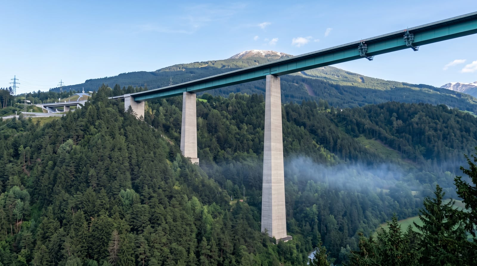
The Europabrucke carries the Brenner motorway across the Sill valley on a line of tall piers, with the roadway running close to two hundred metres above the valley floor. Opened in the early 1960s, it turned the crossing between Germany and Italy into a straight run and became the image most people carry of the Brenner route. A rest area at the southern end gives a view along the span and down to the river, the old valley road and the rail line threading below, and bungee jumps of 192 metres are made from the bridge. From the village of Schonberg on the slope above, the whole structure reads against the Stubai peaks.
What to look for
- The bungee jump - a 192-metre drop from the bridge into the Sill valley.
- The view from Schonberg - the vantage on the slope where the full span shows against the mountains.
- The valley below - the old Brenner road, the river and the railway threaded under the piers.
- The Stubai peaks - the range that closes the view west from the crossing.
When to go
Clear days from late spring to autumn, when the Stubai range is visible. Traffic is heaviest on summer weekends and during Italian holiday changeovers, and the motorway noise never stops. Early morning is calmest. Autumn fog filling the valley below can be more interesting than a clear view.
Before you go
This is a working motorway, and the rest area beside it is loud, windy and thick with exhaust. There is nothing to do beyond looking, so budget half an hour at most. Parking at the rest area is laid out for lorries and fills up.
Nearby
Innsbruck is fifteen minutes north, and the Stubai and Wipptal valleys open on either side.
Key facts
Source: Wikidata, item Q520543, read on 18 October 2026.
What to pack for The Europabrucke
Chosen from what this place is for. Tap a kit for the full checklist.
- Comfortable walking shoes - Sightseeing means kilometres of pavement and cobbles daily. Find on Amazon
- A slim anti-theft daypack - Zips that close properly; keep it in front in crowds and on transit. Find on Amazon
- A refillable water bottle - Many cities have public fountains; save money and plastic. Find on Amazon
- A light layer + compact umbrella - For museum air-con and a sudden shower. Find on Amazon
Some links on this page are Amazon affiliate links - if you buy through them we may earn a small commission at no extra cost to you.
All packing kitsPlan your trip
Where to start if The Europabrucke is going on the list.
Booking links on this page are affiliate links - if you book through them we may earn a small commission at no extra cost to you. It never changes what we write about a place.
Opening times, ticket prices and seasonal closures change - check the official source before you go: official site.