Gibb River Road
Six hundred and sixty kilometres of dirt across the Kimberley, linking gorges, waterfalls and cattle stations.
Updated 4 September 2026

AI illustration
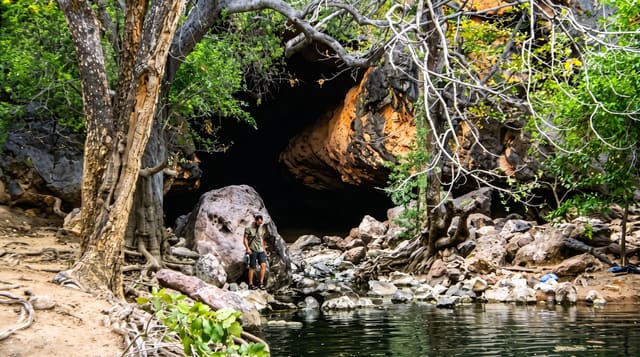
The Gibb River Road was built to move cattle from Kimberley stations to the ports and has become the region's defining road trip: about six hundred and sixty kilometres of dirt between Derby and Kununurra, crossing rivers, ranges and cattle stations the size of small countries. Along it and on side tracks lie the gorges that give the route its reputation, Windjana, Bell, Galvans, Manning, Adcock, Barnett River and Emma Gorge, most with waterholes to swim in below waterfalls that run hardest early in the dry. Stations along the way offer camping and meals. The road closes entirely through the wet season and reopens progressively from around April.
What you'll find
- The gorges - Bell, Manning, Galvans and Emma among many along the route.
- The river crossings - the Pentecost and other fords, deepest early in the season.
- The cattle stations - working properties offering camping and fuel.
- The Cockburn Range - the escarpment above the Pentecost crossing.
When to go
May to September; the road is closed through the wet, usually from November to April, and reopens in stages. Waterfalls run best early in the dry, from May to June. By September many falls have stopped and the heat is building.
What to expect
Four-wheel drive is required and tyre damage is routine; two spares are standard advice and hire agreements often exclude the road. Fuel stops are far apart and expensive. Freshwater crocodiles are in most gorges and estuarine crocodiles in some rivers. There is no phone coverage for most of the route.
Nearby
Derby is the western end; Kununurra and El Questro lie east.
What to pack for Gibb River Road
Chosen from what this place is for. Tap a kit for the full checklist.
- Comfortable walking shoes - Sightseeing means kilometres of pavement and cobbles daily. Find on Amazon
- Shelter suited to the place - Tent, tarp or hut booking - match it to the terrain and rules. Find on Amazon
- A slim anti-theft daypack - Zips that close properly; keep it in front in crowds and on transit. Find on Amazon
- A warm sleeping bag + mat - Rated a little colder than you expect the nights to be. Find on Amazon
Some links on this page are Amazon affiliate links - if you buy through them we may earn a small commission at no extra cost to you.
All packing kitsPlan your trip
Where to start if Gibb River Road is going on the list.
Booking links on this page are affiliate links - if you book through them we may earn a small commission at no extra cost to you. It never changes what we write about a place.
Opening times, ticket prices and seasonal closures change - check the official source before you go: official site.